|
search place name
|
||
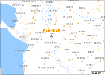
Peshkëpi (Vlorë, Albania)Peshkëpi is a town in the Vlorë region of Albania. An overview map of the region around Peshkëpi is displayed below.
regional and 3d topo map of Peshkëpi, Albania ::
Peshkëpi airports ::
The nearest airport is CFU - Kerkyra/corfu Ioannis Kapodistrias Intl, located 100.6 km south of Peshkëpi.
Other airports nearby include TIA - Tirana Rinas (105.2 km north), OHD - Ohrid (125.3 km north east), LCC - Lecce (126.1 km west), IOA - Ioannina (136.2 km south east), Nearby towns ::
Penkovë (1.2km north) //
Drashovicë (2.9km south) //
Vezhdanisht (2.6km north east) //
Kropisht (3.2km south east) //
Xhyherinë (3.2km west) //
Lubonjë (4.1km north) //
Lagjja e Re (3.2km east) //
Janaj (4.5km south) //
Veliaj (4.9km north) //
Picar (5.5km north) //
Sherishtë (4.5km west) //
Gran (5.2km north east) //
Boriç (6.1km north) //
Treblovë (4.8km east) //
Vodicë (6.4km south) //
Vllahinë (5.2km east) //
Mavrovë (7.1km south) //
Armen (7.1km north) //
Risili (5.9km north west) //
Moçale (6.1km north east) //
Petë (6.7km south east) //
Çeprat (6.5km north west) //
Kocul (6.1km east) //
Babica e Madhe (6.2km west) //
Kaninë (6.7km south west) //
(( Piçkat )) (6.3km east) //
Selenicë (7.7km north east) //
Mesarak (8.6km north) //
(( Millonë )) (8.5km south) //
[all distances 'as the bird flies' and approximate] 
Disclaimer :: Information on this page comes without warranty of any kind |
||
|
Where is Peshkëpi? Elevation and coordinates ::
Latitude (lat): 40°28'22"N Longitude (lon): 19°35'8"E
Elevation (approx.): 59m (map arrows pan, magnifying glasses zoom) |
||
|
Visiting Peshkëpi? Hotel/Accommodation ::
Book a hotel in Peshkëpi Travel Guide ::
Buy a travel guide for Albania rental cars ::
car rental offers GPS waypoint ::
download a GPX waypoint (PoI) of Peshkëpi for your GPS receiver
|
||