|
search place name
|
||
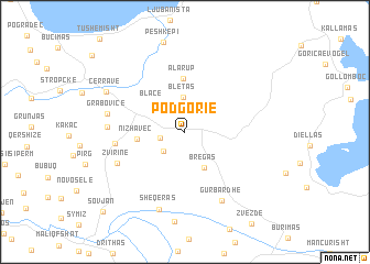
Podgorie (Korçë, Albania)Podgorie is a town in the Korçë region of Albania. An overview map of the region around Podgorie is displayed below.
regional and 3d topo map of Podgorie, Albania ::
Podgorie airports ::
The nearest airport is OHD - Ohrid, located 40.8 km north of Podgorie.
Other airports nearby include KSO - Kastoria Aristotelis (58.0 km south east), KZI - Kozani Filippos (106.1 km south east), TIA - Tirana Rinas (112.3 km north west), IOA - Ioannina (124.2 km south), Nearby towns ::
Kapotë (2.0km west) //
Vreshtas (2.6km south west) //
Bletas (3.6km north) //
Bregas (4.0km south) //
Blacë (3.8km north west) //
Nizhavec (3.8km west) //
Alarup (5.5km north) //
Veliternë (5.5km west) //
Zvirinë (6.1km south west) //
Pretushë (6.0km west) //
Gurbardhë (7.6km south) //
Grabovicë (6.3km west) //
Sheqeras (8.1km south) //
Çërravë (7.3km north west) //
Sovjan (10.2km south west) //
[all distances 'as the bird flies' and approximate]  Places with similar names to Podgorie, Albania ::
Disclaimer :: Information on this page comes without warranty of any kind |
||
|
Where is Podgorie? Elevation and coordinates ::
Latitude (lat): 40°48'54"N Longitude (lon): 20°47'49"E
Elevation (approx.): 889m (map arrows pan, magnifying glasses zoom) |
||
|
Visiting Podgorie? Hotel/Accommodation ::
Book a hotel in Podgorie Travel Guide ::
Buy a travel guide for Albania rental cars ::
car rental offers GPS waypoint ::
download a GPX waypoint (PoI) of Podgorie for your GPS receiver
|
||