|
search place name
|
||
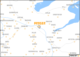
Progër (Korçë, Albania)Progër is a town in the Korçë region of Albania. An overview map of the region around Progër is displayed below.
regional and 3d topo map of Progër, Albania ::
Progër airports ::
The nearest airport is KSO - Kastoria Aristotelis, located 39.9 km south east of Progër.
Other airports nearby include OHD - Ohrid (56.5 km north), KZI - Kozani Filippos (88.8 km south east), IOA - Ioannina (111.2 km south), TIA - Tirana Rinas (130.1 km north west), Nearby towns ::
Mançurisht (1.4km north west) //
Cangonj (2.7km west) //
(( Pilur )) (3.6km south west) //
Vranisht (4.1km south west) //
Rakickë (3.9km north east) //
Eçmenik (5.5km south west) //
Bickë (4.9km south west) //
Burimas (4.9km north west) //
Shuec (5.0km east) //
Stropan (6.4km south west) //
Baban (6.9km south) //
Bitinckë (6.3km south east) //
Zëmblak (5.4km west) //
Tren (5.9km south east) //
Cerjë (6.9km north east) //
Buzëliqen (6.6km east) //
Zaroshkë (8.2km north) //
Gracë (8.6km south) //
Bilisht (8.5km south east) //
Vronterón (8.3km north east) //
[all distances 'as the bird flies' and approximate] 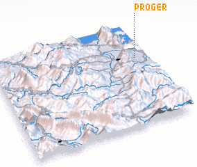 Places with similar names to Progër, Albania ::
Disclaimer :: Information on this page comes without warranty of any kind |
||
|
Where is Progër? Elevation and coordinates ::
Latitude (lat): 40°41'39"N Longitude (lon): 20°56'25"E
Elevation (approx.): 845m (map arrows pan, magnifying glasses zoom) |
||
|
Visiting Progër? Hotel/Accommodation ::
Book a hotel in Progër Travel Guide ::
Buy a travel guide for Albania rental cars ::
car rental offers GPS waypoint ::
download a GPX waypoint (PoI) of Progër for your GPS receiver
|
||