|
search place name
|
||
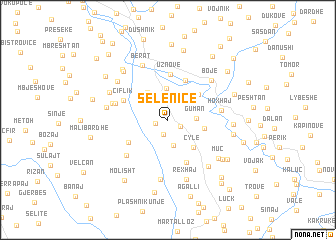
Selenicë (Berat, Albania)Selenicë is a town in the Berat region of Albania. An overview map of the region around Selenicë is displayed below.
regional and 3d topo map of Selenicë, Albania ::
Selenicë airports ::
The nearest airport is OHD - Ohrid, located 87.1 km north east of Selenicë.
Other airports nearby include TIA - Tirana Rinas (87.5 km north), KSO - Kastoria Aristotelis (112.8 km east), CFU - Kerkyra/corfu Ioannis Kapodistrias Intl (116.7 km south), IOA - Ioannina (128.1 km south east), Nearby towns ::
Bardhaj (1.2km west) //
Zhitomi i Vogël (1.3km south east) //
Izvicë (1.6km south) //
Bejkollat (2.2km north east) //
Mesit (2.9km north) //
Zhitomi i Madh (2.9km south) //
Guman (2.4km east) //
Bilçë (3.6km north) //
Drobonik (3.5km north west) //
Cyle (3.7km south east) //
Qorraj (3.3km east) //
Vodicë (3.8km north east) //
Kullah (4.6km north) //
Veleshnjë (4.2km south west) //
Uznovë (5.1km north) //
Kucaj (5.0km south) //
Çiflik (4.3km north west) //
Hoxhaj (4.7km east) //
Vrekaj (5.3km south west) //
Gjeroven (4.8km west) //
Gjeroven (5.0km west) //
Bojë (5.7km north east) //
Berat (6.4km north) //
Gjonaj (6.7km south) //
Kuçovë (6.2km south east) //
Tulaj (5.4km west) //
Rexhaj (6.8km south) //
Benollarët (6.1km north west) //
Muç (6.1km south east) //
[all distances 'as the bird flies' and approximate]  Places with similar names to Selenicë, Albania ::
Disclaimer :: Information on this page comes without warranty of any kind |
||
|
Where is Selenicë? Elevation and coordinates ::
Latitude (lat): 40°39'5"N Longitude (lon): 19°58'40"E
Elevation (approx.): 440m (map arrows pan, magnifying glasses zoom) |
||
|
Visiting Selenicë? Hotel/Accommodation ::
Book a hotel in Selenicë Travel Guide ::
Buy a travel guide for Albania rental cars ::
car rental offers GPS waypoint ::
download a GPX waypoint (PoI) of Selenicë for your GPS receiver
|
||