|
search place name
|
||
Shakotë (Shkodër, Albania)Shakotë is a town in the Shkodër region of Albania. An overview map of the region around Shakotë is displayed below.
regional and 3d topo map of Shakotë, Albania ::

Shakotë airports ::
The nearest airport is TGD - Podgorica, located 35.1 km north west of Shakotë.
Other airports nearby include TIV - Tivat (76.3 km west), TIA - Tirana Rinas (84.6 km south), DBV - Dubrovnik (117.5 km west), PRN - Pristina (127.0 km east), Nearby towns ::
Motaj (0.6km south east) //
Garuç (1.1km south) //
Fushʼ e Arrasit (1.3km north east) //
Fushʼ e Marlanajt (1.7km north) //
Kulmerijë (1.4km east) //
Derraj (1.6km south east) //
Fushʼ e Thatë (2.1km north east) //
Plisht (2.8km south) //
Vorfë e Sipërm (2.3km west) //
Kujmjet (2.5km north east) //
Domën (3.6km south) //
Vorfë (3.3km south west) //
Kurtaj (3.5km north west) //
Rekal (3.4km south east) //
Milan (4.6km south) //
Papaj (4.6km north) //
Kurt-Kurtaj (4.4km north west) //
Portat (4.1km north east) //
Burg (4.4km north west) //
Maslac (5.0km south) //
Linaj-Egç-Lepurosh (3.9km west) //
Drisht (5.2km south) //
Rrash i Vorfës (4.3km south west) //
Gjelaj (5.4km north) //
Çokaj (5.3km north west) //
Rotacit (4.4km east) //
Amarej (5.1km south east) //
Boks (5.7km south) //
Bukmirë (5.1km north east) //
[all distances 'as the bird flies' and approximate] 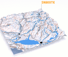 Places with similar names to Shakotë, Albania ::
Disclaimer :: Information on this page comes without warranty of any kind |
||
|
Where is Shakotë? Elevation and coordinates ::
Latitude (lat): 42°10'12"N Longitude (lon): 19°35'35"E
Elevation (approx.): 490m (map arrows pan, magnifying glasses zoom) |
||
|
Visiting Shakotë? Hotel/Accommodation ::
Book a hotel in Shakotë Travel Guide ::
Buy a travel guide for Albania rental cars ::
car rental offers GPS waypoint ::
download a GPX waypoint (PoI) of Shakotë for your GPS receiver
|
||