|
search place name
|
||
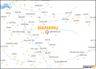
Skënderaj (Dibër, Albania)Skënderaj is a town in the Dibër region of Albania. An overview map of the region around Skënderaj is displayed below.
regional and 3d topo map of Skënderaj, Albania ::
Skënderaj airports ::
The nearest airport is TIA - Tirana Rinas, located 37.6 km south west of Skënderaj.
Other airports nearby include OHD - Ohrid (68.5 km south east), TGD - Podgorica (112.6 km north west), SKP - Skopje (132.3 km east), PRN - Pristina (134.3 km north east), Nearby towns ::
Kurdari (1.6km west) //
Tumë (2.1km west) //
Qaf-Dardhë (2.2km east) //
Patin (3.1km south) //
Kurqelaj (2.9km north west) //
Gjalish (4.2km north) //
Kujtim (3.6km west) //
Cërujë (5.1km south) //
Bershin (4.9km south west) //
Vinjoll (5.9km north) //
Kukatin (6.2km south) //
Lis (6.1km north west) //
Pleshë (6.6km south) //
Mallunxë (5.3km north west) //
Suç (5.4km west) //
Vig (7.1km north) //
Salaj (6.0km north west) //
Shëlli (7.7km north) //
Dom (6.0km west) //
Shulbatër (6.4km south west) //
Bejnë (8.1km south) //
Klos (8.2km south) //
Fullqet (7.8km south west) //
Mazdre (7.2km north east) //
Burgajet (8.5km north west) //
Mishtër (8.9km south west) //
Bel (9.7km south west) //
Selitë (9.6km north east) //
[all distances 'as the bird flies' and approximate] 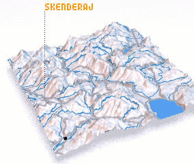 Places with similar names to Skënderaj, Albania ::
// Skenderija (BA)
// Skenderije (BA)
Disclaimer :: Information on this page comes without warranty of any kind |
||
|
Where is Skënderaj? Elevation and coordinates ::
Latitude (lat): 41°34'38"N Longitude (lon): 20°6'57"E
Elevation (approx.): 549m (map arrows pan, magnifying glasses zoom) |
||
|
Visiting Skënderaj? Hotel/Accommodation ::
Book a hotel in Skënderaj Travel Guide ::
Buy a travel guide for Albania rental cars ::
car rental offers GPS waypoint ::
download a GPX waypoint (PoI) of Skënderaj for your GPS receiver
|
||