|
search place name
|
||
Spaç (Lezhë, Albania)Spaç is a town in the Lezhë region of Albania. An overview map of the region around Spaç is displayed below.
regional and 3d topo map of Spaç, Albania ::

Spaç airports ::
The nearest airport is TIA - Tirana Rinas, located 60.2 km south west of Spaç.
Other airports nearby include TGD - Podgorica (83.3 km north west), OHD - Ohrid (98.7 km south east), PRN - Pristina (110.9 km north east), TIV - Tivat (122.9 km north west), Nearby towns ::
(( Plakëz )) (2.1km north) //
Kodër-Spaç (2.5km south) //
Katundi i Sipërm (3.3km north) //
Gurth-Spaç (2.9km north east) //
Mashtërkor (3.5km south east) //
Reps (3.9km south west) //
Dom (4.6km north west) //
Gjegjan (5.2km north west) //
Mesul (5.8km north) //
Shtrungaj (4.7km east) //
Grykë-Orosh (5.5km south east) //
Bulshar (6.1km south) //
(( Letaj )) (5.9km south west) //
Kullaxhi (5.9km south west) //
Blinisht (5.6km south west) //
Vilë (5.2km south east) //
Mushtë (6.6km north) //
Planetë (6.8km south) //
Rras (5.3km west) //
Kuk (6.8km north west) //
Kuzhnen (5.8km west) //
Gojani i Vogël (7.4km north west) //
Nënshenjt (6.5km south east) //
Vigjë (8.0km north) //
Trojë (8.2km south) //
Orosh (7.9km south east) //
Kalivare (8.2km north) //
Peshqesh (7.2km south west) //
Bisak (6.4km east) //
[all distances 'as the bird flies' and approximate] 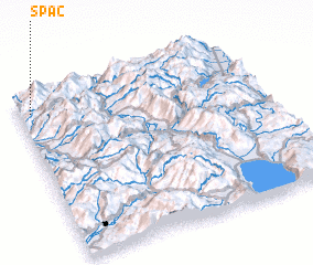 Places with similar names to Spaç, Albania ::
Disclaimer :: Information on this page comes without warranty of any kind |
||
|
Where is Spaç? Elevation and coordinates ::
Latitude (lat): 41°53'54"N Longitude (lon): 20°2'45"E
Elevation (approx.): 575m (map arrows pan, magnifying glasses zoom) |
||
|
Visiting Spaç? Hotel/Accommodation ::
Book a hotel in Spaç Travel Guide ::
Buy a travel guide for Albania rental cars ::
car rental offers GPS waypoint ::
download a GPX waypoint (PoI) of Spaç for your GPS receiver
|
||