|
search place name
|
||
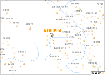
Stravaj (Elbasan, Albania)Stravaj is a town in the Elbasan region of Albania. An overview map of the region around Stravaj is displayed below.
regional and 3d topo map of Stravaj, Albania ::
Stravaj airports ::
The nearest airport is OHD - Ohrid, located 33.1 km north east of Stravaj.
Other airports nearby include TIA - Tirana Rinas (74.4 km north west), KSO - Kastoria Aristotelis (95.5 km south east), KZI - Kozani Filippos (144.1 km south east), SKP - Skopje (145.9 km north east), Nearby towns ::
Qershizë (0.9km south) //
Shqiponjë (1.5km west) //
Senisht (1.9km south) //
Bratilës (1.7km south west) //
Farret (2.1km east) //
Zall-Liras (3.0km south west) //
Stranik (4.0km east) //
Baribardhë (4.1km east) //
Buzahishtë (5.3km south east) //
Bërzeshtë (5.9km north east) //
Slatinë (5.1km east) //
Fanjë (5.8km north east) //
Laktesh (5.6km south east) //
Velçan (6.5km south east) //
Gurrë (7.4km north) //
Bishnicë (7.9km south) //
Cencë (7.6km south east) //
Dritaj (6.6km north east) //
(( Breshkë )) (6.9km north west) //
Gaferr (7.1km north west) //
Qukës-Skënderbe (8.8km north) //
Karkavec (8.0km north east) //
Zall-Torë (6.9km east) //
Proptisht (7.0km east) //
Losnik (8.4km south east) //
Slabinjë (9.3km south east) //
[all distances 'as the bird flies' and approximate] 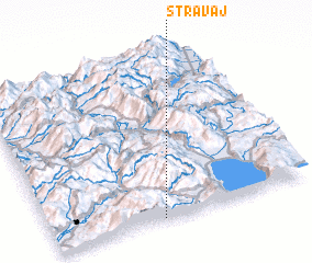 Places with similar names to Stravaj, Albania ::
// Strovija (MK)
// Cedro Viejo (MX)
Disclaimer :: Information on this page comes without warranty of any kind |
||
|
Where is Stravaj? Elevation and coordinates ::
Latitude (lat): 41°0'19"N Longitude (lon): 20°25'23"E
Elevation (approx.): 729m (map arrows pan, magnifying glasses zoom) |
||
|
Visiting Stravaj? Hotel/Accommodation ::
Book a hotel in Stravaj Travel Guide ::
Buy a travel guide for Albania rental cars ::
car rental offers GPS waypoint ::
download a GPX waypoint (PoI) of Stravaj for your GPS receiver
|
||