|
search place name
|
||
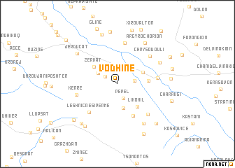
Vodhinë (Gjirokastër, Albania)Vodhinë is a town in the Gjirokastër region of Albania. An overview map of the region around Vodhinë is displayed below.
regional and 3d topo map of Vodhinë, Albania ::
Vodhinë airports ::
The nearest airport is CFU - Kerkyra/corfu Ioannis Kapodistrias Intl, located 47.6 km south west of Vodhinë.
Other airports nearby include IOA - Ioannina (48.1 km south east), KSO - Kastoria Aristotelis (102.4 km north east), PVK - Preveza Aktio (113.9 km south), KZI - Kozani Filippos (136.8 km east), Nearby towns ::
Bodrishtë (1.9km north west) //
Pepel (2.4km south) //
Vrisera (2.1km east) //
Bularat (2.9km north west) //
Klishar (3.9km south) //
Kakavijë (3.6km north east) //
Zervat (4.0km north west) //
Likomil (4.4km south east) //
Dritë (3.9km east) //
Selo (5.4km south) //
Leshnica e Sipërme (5.7km south west) //
Neochórion (5.0km east) //
Radat (6.6km north) //
Kërrë (5.3km west) //
Chrysódouli (6.0km north east) //
Llovinë (6.2km south east) //
Mavrópoulon (6.2km north east) //
Krioner (7.1km south east) //
Argyrochórion (7.4km north east) //
Jergucat (6.9km north west) //
Peshkëpia e Poshtme (8.1km north) //
Peshkëpia e Sipërme (8.4km north) //
Leskovec (7.8km south west) //
Alopul (7.7km south west) //
Ktísmata (6.6km east) //
Llongo (7.9km south east) //
Oreinón (8.8km north) //
Leshnica e Poshtme (7.8km south west) //
Sotirë (8.6km south) //
[all distances 'as the bird flies' and approximate] 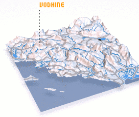 Places with similar names to Vodhinë, Albania ::
Disclaimer :: Information on this page comes without warranty of any kind |
||
|
Where is Vodhinë? Elevation and coordinates ::
Latitude (lat): 39°53'30"N Longitude (lon): 20°19'17"E
Elevation (approx.): 506m (map arrows pan, magnifying glasses zoom) |
||
|
Visiting Vodhinë? Hotel/Accommodation ::
Book a hotel in Vodhinë Travel Guide ::
Buy a travel guide for Albania rental cars ::
car rental offers GPS waypoint ::
download a GPX waypoint (PoI) of Vodhinë for your GPS receiver
|
||