|
search place name
|
||
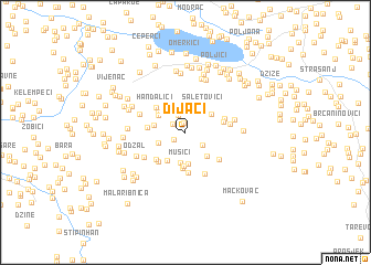
Dijaci (Bosnia and Herzegovina)Dijaci is a town in Bosnia and Herzegovina. An overview map of the region around Dijaci is displayed below.
regional and 3d topo map of Dijaci, Bosnia and Herzegovina ::
Dijaci airports ::
The nearest airport is SJJ - Sarajevo, located 67.3 km south of Dijaci.
Other airports nearby include OSI - Osijek (118.6 km north), OMO - Mostar (136.8 km south west), BEG - Beograd (149.7 km east), DBV - Dubrovnik (207.1 km south), Nearby towns ::
Grivice (1.0km north) //
Čifluk (1.1km south west) //
Pirići (1.2km north west) //
Avdići (1.8km north) //
Banovići (1.8km south east) //
Mrdići (2.4km north) //
Gornja Bučik (2.4km north east) //
Gaj (2.4km north west) //
Savići (2.2km south west) //
Saletovići (2.8km north east) //
Mušići (3.1km south) //
Lugavići (2.6km north east) //
Sinanovići (3.2km south) //
Radina (2.9km south east) //
Tulovići (2.6km north west) //
Draganja (2.4km west) //
Hamzići (3.1km south west) //
Repnik (3.4km south) //
Delići (2.9km north west) //
Bečići (3.6km south) //
Saihovac (2.8km west) //
Handalići (3.3km north west) //
Denkovci (3.5km south west) //
Podgorje (3.4km south west) //
Omazići (3.0km east) //
Nasubašići (4.1km south) //
Gutići (3.1km north east) //
Hrvati (3.6km south east) //
Mrljevići (4.4km south) //
[all distances 'as the bird flies' and approximate]  Places with similar names to Dijaci, Bosnia and Herzegovina ::
Disclaimer :: Information on this page comes without warranty of any kind |
||
|
Where is Dijaci? Elevation and coordinates ::
Latitude (lat): 44°25'1"N Longitude (lon): 18°30'30"E
Elevation (approx.): 373m (map arrows pan, magnifying glasses zoom) |
||
|
Visiting Dijaci? Hotel/Accommodation ::
Book a hotel in Dijaci Travel Guide ::
rental cars ::
car rental offers GPS waypoint ::
download a GPX waypoint (PoI) of Dijaci for your GPS receiver
|
||