|
search place name
|
||
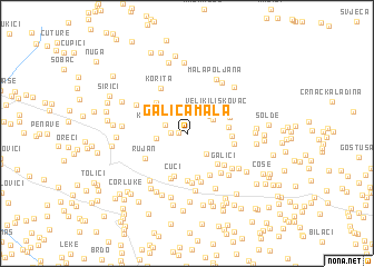
Galića Mala (Federacija Bosne i Hercegovine, Bosnia and Herzegovina)Galića Mala is a town in the Federacija Bosne i Hercegovine region of Bosnia and Herzegovina. An overview map of the region around Galića Mala is displayed below.
regional and 3d topo map of Galića Mala, Bosnia and Herzegovina ::
Galića Mala airports ::
The nearest airport is OMO - Mostar, located 34.6 km south east of Galića Mala.
Other airports nearby include SJJ - Sarajevo (81.0 km north east), SPU - Split (96.1 km west), DBV - Dubrovnik (117.0 km south east), TIV - Tivat (153.5 km south east), Nearby towns ::
Solde (0.7km west) //
Crne Lokve (1.2km west) //
Kidačke Njive (1.9km north west) //
Lončaruše (2.4km south east) //
Gornja Britvica (2.4km north east) //
Vranjkova Lazina (2.3km north east) //
Galići (2.3km west) //
Veliki Liskovac (3.2km north east) //
Mali Liskovac (3.1km east) //
Ljubići (3.7km south east) //
Medine Stanine (3.8km north west) //
Ćuci (4.3km south) //
Solde (3.2km east) //
Ćukova Glavica (4.5km south) //
Pogana Kruška (3.5km north east) //
Bazine (4.6km south) //
Sabljići (4.4km south) //
Budim (4.6km south) //
Donja Britvica (3.5km east) //
Galići (4.1km south east) //
Rujan (4.0km south west) //
Sutani (4.9km south) //
Marušići (4.9km south) //
Vukoje (4.5km south east) //
Korita (4.9km north west) //
Ljubotići (4.7km south east) //
Kočerin (5.7km south) //
Kvesići (5.1km south east) //
Milićevići (4.7km north west) //
[all distances 'as the bird flies' and approximate]  Places with similar names to Galića Mala, Bosnia and Herzegovina ::
// Gałki Małe (PL)
// Gałków Mały (PL)
// Kołaki Małe (PL)
// Click Mill (US)
// Kalugumalai (IN)
// Galagammulla (LK)
// Kalū Kamālī (IR)
// Kāla Kamāla (PK)
// Colića Mala (CS)
// Colićka Mala (CS)
Disclaimer :: Information on this page comes without warranty of any kind |
||
|
Where is Galića Mala? Elevation and coordinates ::
Latitude (lat): 43°26'26"N Longitude (lon): 17°28'42"E
Elevation (approx.): 761m (map arrows pan, magnifying glasses zoom) |
||
|
Visiting Galića Mala? Hotel/Accommodation ::
Book a hotel in Galića Mala Travel Guide ::
rental cars ::
car rental offers GPS waypoint ::
download a GPX waypoint (PoI) of Galića Mala for your GPS receiver
|
||