|
search place name
|
||
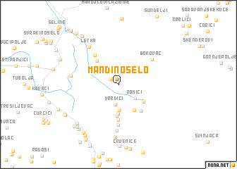
Mandino Selo (Federacija Bosne i Hercegovine, Bosnia and Herzegovina)Mandino Selo is a town in the Federacija Bosne i Hercegovine region of Bosnia and Herzegovina. An overview map of the region around Mandino Selo is displayed below.
regional and 3d topo map of Mandino Selo, Bosnia and Herzegovina ::
Mandino Selo airports ::
The nearest airport is OMO - Mostar, located 62.1 km south east of Mandino Selo.
Other airports nearby include SPU - Split (83.2 km west), SJJ - Sarajevo (83.8 km east), DBV - Dubrovnik (147.0 km south east), ZAD - Zadar (164.7 km west), Nearby towns ::
Rašćani (1.4km north west) //
Vardići (3.2km south) //
Romići (2.8km south east) //
Srđani (3.1km north west) //
Čeline (4.0km south) //
Borčani (4.5km south) //
Kongora (4.4km south east) //
Lipa (3.9km south east) //
Kneževići (4.9km south) //
Oplećani (4.5km north west) //
Galići (4.8km south east) //
Čevrči (5.6km south) //
Vedašić (5.4km north west) //
Omolje (6.4km south) //
Borovac (5.5km north east) //
Rošci (7.2km south) //
Letka (6.8km north west) //
Ćavarov Stan (5.6km west) //
Seonica (8.3km south) //
Mrkodol (7.8km south west) //
Kelave (8.6km south west) //
Andrići (8.3km south west) //
Pokrajćići (8.2km south west) //
Sarajlije (8.7km north west) //
Anići (8.9km south west) //
Brižani (8.3km south west) //
Ćerdić (7.7km south west) //
Donji Brišnik (7.8km south west) //
Bukovica (9.5km south west) //
[all distances 'as the bird flies' and approximate] 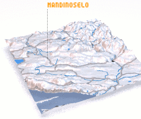 Places with similar names to Mandino Selo, Bosnia and Herzegovina ::
// Montaña Azul (CR)
// Mandoncillo (PE)
Disclaimer :: Information on this page comes without warranty of any kind |
||
|
Where is Mandino Selo? Elevation and coordinates ::
Latitude (lat): 43°40'57"N Longitude (lon): 17°18'35"E
Elevation (approx.): 873m (map arrows pan, magnifying glasses zoom) |
||
|
Visiting Mandino Selo? Hotel/Accommodation ::
Book a hotel in Mandino Selo Travel Guide ::
rental cars ::
car rental offers GPS waypoint ::
download a GPX waypoint (PoI) of Mandino Selo for your GPS receiver
|
||