|
search place name
|
||
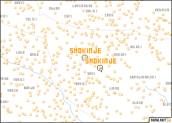
Smokinje (Federacija Bosne i Hercegovine, Bosnia and Herzegovina)Smokinje is a town in the Federacija Bosne i Hercegovine region of Bosnia and Herzegovina. An overview map of the region around Smokinje is displayed below.
regional and 3d topo map of Smokinje, Bosnia and Herzegovina ::
Smokinje airports ::
The nearest airport is OMO - Mostar, located 28.3 km east of Smokinje.
Other airports nearby include SJJ - Sarajevo (87.2 km north east), SPU - Split (100.3 km west), DBV - Dubrovnik (105.3 km south east), TIV - Tivat (142.8 km south east), Nearby towns ::
Donje Dužice (0.2km north) //
Sliškovići (0.2km south east) //
Šantići (0.9km north west) //
Palčušići (1.0km north) //
Brkići (0.9km south east) //
Priodi (1.2km south west) //
Radići (1.5km south east) //
Vratlo (2.0km north) //
Prokos (2.1km south) //
Mikulići (2.1km south west) //
Kvesića Staje (2.0km south east) //
Lokvari (1.9km west) //
Podledinac (2.2km north west) //
Brkići (2.0km north east) //
Galešin Dolac (2.1km south west) //
Ledinac (2.7km north west) //
Tabakovići (2.4km south west) //
Adžići (2.7km north east) //
Šimići (2.9km south west) //
Sopte (3.2km north) //
Rutavica (2.7km south east) //
Zadre (3.4km south) //
Borajna (3.1km south west) //
Tomići (2.6km west) //
Rasno (2.7km east) //
Donji Mamići (2.9km north west) //
Dužice (3.7km north) //
Ševi (3.7km south) //
Čolaci (3.6km north west) //
[all distances 'as the bird flies' and approximate]  Places with similar names to Smokinje, Bosnia and Herzegovina ::
Disclaimer :: Information on this page comes without warranty of any kind |
||
|
Where is Smokinje? Elevation and coordinates ::
Latitude (lat): 43°19'22"N Longitude (lon): 17°30'3"E
Elevation (approx.): 363m (map arrows pan, magnifying glasses zoom) |
||
|
Visiting Smokinje? Hotel/Accommodation ::
Book a hotel in Smokinje Travel Guide ::
rental cars ::
car rental offers GPS waypoint ::
download a GPX waypoint (PoI) of Smokinje for your GPS receiver
|
||