|
search place name
|
||
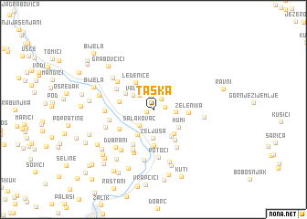
Taška (Federacija Bosne i Hercegovine, Bosnia and Herzegovina)Taška is a town in the Federacija Bosne i Hercegovine region of Bosnia and Herzegovina. An overview map of the region around Taška is displayed below.
regional and 3d topo map of Taška, Bosnia and Herzegovina ::
Taška airports ::
The nearest airport is OMO - Mostar, located 19.9 km south of Taška.
Other airports nearby include SJJ - Sarajevo (54.8 km north east), DBV - Dubrovnik (105.0 km south), SPU - Split (127.7 km west), TIV - Tivat (136.4 km south east), Nearby towns ::
Prigrađani (0.7km west) //
Otolež (1.4km north) //
Podgorani (1.0km east) //
Selište (1.5km north east) //
Lijeska (2.2km north west) //
Salakovac (2.3km south west) //
Dolac (2.0km east) //
Vala (2.5km north west) //
Željuša (3.5km south) //
Donji Bučići (3.4km south west) //
Humi (3.1km south east) //
Vejzovica Han (3.4km south east) //
Humilišani (3.6km south east) //
Bresnica (3.2km north west) //
Ledenice (3.7km north west) //
Markanovina (3.2km west) //
Zelenika (3.1km east) //
Trišića Han (4.4km south) //
Lišani (4.2km south east) //
Klak (3.9km south west) //
Gornji Bučići (4.7km south west) //
Zeleni Dol (4.2km north west) //
Bošnjaci (5.1km south east) //
Nazdrajić Mahala (4.7km north west) //
(( Raška Gora )) (5.3km south) //
Vituša (4.2km west) //
Kovačice (5.6km south) //
Potoci (5.9km south) //
Jedrinje (4.3km west) //
[all distances 'as the bird flies' and approximate] 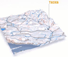 Places with similar names to Taška, Bosnia and Herzegovina ::
Disclaimer :: Information on this page comes without warranty of any kind |
||
|
Where is Taška? Elevation and coordinates ::
Latitude (lat): 43°27'40"N Longitude (lon): 17°52'22"E
Elevation (approx.): 268m (map arrows pan, magnifying glasses zoom) |
||
|
Visiting Taška? Hotel/Accommodation ::
Book a hotel in Taška Travel Guide ::
rental cars ::
car rental offers GPS waypoint ::
download a GPX waypoint (PoI) of Taška for your GPS receiver
|
||