|
search place name
|
||
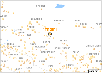
Topići (Federacija Bosne i Hercegovine, Bosnia and Herzegovina)Topići is a town in the Federacija Bosne i Hercegovine region of Bosnia and Herzegovina. An overview map of the region around Topići is displayed below.
regional and 3d topo map of Topići, Bosnia and Herzegovina ::
Topići airports ::
The nearest airport is OMO - Mostar, located 39.8 km south east of Topići.
Other airports nearby include SJJ - Sarajevo (78.0 km north east), SPU - Split (94.6 km west), DBV - Dubrovnik (124.0 km south east), TIV - Tivat (160.0 km south east), Nearby towns ::
Nikolići (0.8km south west) //
Perci (0.9km south east) //
Šarića Dolac (1.1km west) //
Donji Vlašani (1.8km north) //
Zagradina (1.8km west) //
Korita (3.4km south) //
Markote (3.8km north west) //
Mihalji (3.7km north west) //
Donji Poklečani (4.1km north west) //
Dupovci (3.4km north west) //
Mala Poljana (3.8km south east) //
Barbići (4.6km north west) //
Medine Stanine (4.9km south) //
Sutina (4.4km south east) //
Raskršće (5.1km north east) //
Rasadine (4.6km west) //
Milićevići (5.6km south west) //
Poklečani (5.5km north west) //
Srednji Poklečani (5.7km north west) //
Donji Konjovac (4.9km south west) //
Pavkovići (5.0km north west) //
Velika Poljana (5.3km south east) //
Veliki Liskovac (6.2km south east) //
Gornja Britvica (6.5km south east) //
Kidačke Njive (6.9km south) //
Cerovi Doci (5.9km south west) //
Marići (5.5km north west) //
Zaglavica (6.5km north west) //
Vranjkova Lazina (6.9km south east) //
[all distances 'as the bird flies' and approximate]  Places with similar names to Topići, Bosnia and Herzegovina ::
Disclaimer :: Information on this page comes without warranty of any kind |
||
|
Where is Topići? Elevation and coordinates ::
Latitude (lat): 43°30'37"N Longitude (lon): 17°28'1"E
Elevation (approx.): 917m (map arrows pan, magnifying glasses zoom) |
||
|
Visiting Topići? Hotel/Accommodation ::
Book a hotel in Topići Travel Guide ::
rental cars ::
car rental offers GPS waypoint ::
download a GPX waypoint (PoI) of Topići for your GPS receiver
|
||