|
search place name
|
||
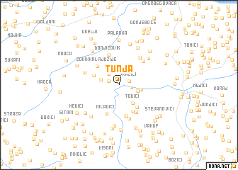
Tunja (Federacija Bosne i Hercegovine, Bosnia and Herzegovina)Tunja is a town in the Federacija Bosne i Hercegovine region of Bosnia and Herzegovina. An overview map of the region around Tunja is displayed below.
regional and 3d topo map of Tunja, Bosnia and Herzegovina ::
Tunja airports ::
The nearest airport is OSI - Osijek, located 81.2 km north of Tunja.
Other airports nearby include SJJ - Sarajevo (106.0 km south), BEG - Beograd (125.2 km east), OMO - Mostar (176.2 km south west), Nearby towns ::
Vražići (1.3km north east) //
Velino Selo (1.3km north west) //
Luka (1.5km east) //
Gornji Zovik (2.1km north west) //
Zečevići (2.2km west) //
Brnjik (2.3km south east) //
Ciganluk (2.6km east) //
Todići (3.3km south east) //
Bunarić (3.2km north west) //
Zovik Kalajdžije (3.8km north west) //
Lukavica (4.0km south east) //
Kaštel (4.5km south) //
Miladići (4.8km south) //
Donji Zovik (4.9km north) //
Popovići (5.0km south) //
Česte (4.7km south east) //
Maholjaši (4.6km north east) //
Ribić (4.8km north east) //
Tešići (5.4km south) //
Štrepci (4.4km north west) //
Šatorovići (5.4km north east) //
Donji Nahvioci (6.5km south) //
Brdo (6.2km north) //
Donji Humći (5.9km south west) //
Bojići (6.5km north) //
Gornji Rahić (6.1km north west) //
Gornji Humci (5.8km south west) //
Gornji Nahvioci (6.9km south) //
Palanka (7.1km north) //
[all distances 'as the bird flies' and approximate]  Places with similar names to Tunja, Bosnia and Herzegovina ::
Disclaimer :: Information on this page comes without warranty of any kind |
||
|
Where is Tunja? Elevation and coordinates ::
Latitude (lat): 44°44'3"N Longitude (lon): 18°43'54"E
Elevation (approx.): 214m (map arrows pan, magnifying glasses zoom) |
||
|
Visiting Tunja? Hotel/Accommodation ::
Book a hotel in Tunja Travel Guide ::
rental cars ::
car rental offers GPS waypoint ::
download a GPX waypoint (PoI) of Tunja for your GPS receiver
|
||