|
search place name
|
||
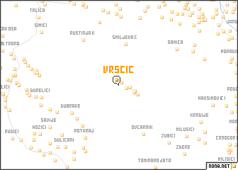
Vrščić (Federacija Bosne i Hercegovine, Bosnia and Herzegovina)Vrščić is a town in the Federacija Bosne i Hercegovine region of Bosnia and Herzegovina. An overview map of the region around Vrščić is displayed below.
regional and 3d topo map of Vrščić, Bosnia and Herzegovina ::
Vrščić airports ::
The nearest airport is SPU - Split, located 85.6 km south west of Vrščić.
Other airports nearby include SJJ - Sarajevo (115.9 km east), OMO - Mostar (119.6 km south east), ZAD - Zadar (128.8 km west), ZAG - Zagreb (190.9 km north), Nearby towns ::
Urija (0.5km north east) //
Rajićka (1.0km north) //
Pribelja (1.0km south east) //
Kopanje (1.3km east) //
Meseldžije (2.1km south east) //
Duvnjaci (2.0km south east) //
Šoboti (2.6km south east) //
Smiljevac (6.5km north) //
Džudžolije (7.1km south west) //
Isakovci (7.6km south west) //
Ovčarnik (8.2km south) //
Dubrave (7.0km south west) //
Pustinjak (8.1km north west) //
Potkraj (9.1km south west) //
[all distances 'as the bird flies' and approximate]  Places with similar names to Vrščić, Bosnia and Herzegovina ::
Disclaimer :: Information on this page comes without warranty of any kind |
||
|
Where is Vrščić? Elevation and coordinates ::
Latitude (lat): 44°8'40"N Longitude (lon): 16°57'21"E
Elevation (approx.): 1238m (map arrows pan, magnifying glasses zoom) |
||
|
Visiting Vrščić? Hotel/Accommodation ::
Book a hotel in Vrščić Travel Guide ::
rental cars ::
car rental offers GPS waypoint ::
download a GPX waypoint (PoI) of Vrščić for your GPS receiver
|
||