|
search place name
|
||
Žanjevica (Bosnia and Herzegovina)Žanjevica is a town in Bosnia and Herzegovina. An overview map of the region around Žanjevica is displayed below.
regional and 3d topo map of Žanjevica, Bosnia and Herzegovina ::

Žanjevica airports ::
The nearest airport is OMO - Mostar, located 65.8 km west of Žanjevica.
Other airports nearby include SJJ - Sarajevo (75.4 km north), DBV - Dubrovnik (75.8 km south west), TIV - Tivat (86.9 km south), TGD - Podgorica (104.3 km south east), Nearby towns ::
Žanjevica (0.6km south east) //
Šljivovica (1.9km south east) //
Berušica (2.5km south) //
Miletići (2.3km east) //
Jasenik (2.7km south west) //
Platice (2.5km west) //
Poljana (2.9km south east) //
Glavice (3.0km west) //
Okiljevići (3.7km south west) //
Mramor (3.8km south east) //
Brajčin Laz (4.7km north) //
Dramešina (4.1km north west) //
Vlaka (4.1km west) //
Lipnik (5.3km south) //
Gaj (4.6km south west) //
Sokolovina (5.7km north) //
Vukovići (5.1km south west) //
Kruščice (5.6km north) //
Krivodo (4.9km south east) //
Ðurđev Do (5.8km south) //
Vitasovina (6.2km north) //
Laništa (5.7km north west) //
Vrtine (6.7km north) //
Mastilovina (6.8km north) //
Jasenje (6.8km north) //
Misijevina (7.1km north) //
Donje Ulinje (5.2km west) //
Ulinje (5.2km west) //
Borje (7.2km north) //
[all distances 'as the bird flies' and approximate] 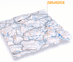 Places with similar names to Žanjevica, Bosnia and Herzegovina ::
Disclaimer :: Information on this page comes without warranty of any kind |
||
|
Where is Žanjevica? Elevation and coordinates ::
Latitude (lat): 43°11'6"N Longitude (lon): 18°38'39"E
Elevation (approx.): 1146m (map arrows pan, magnifying glasses zoom) |
||
|
Visiting Žanjevica? Hotel/Accommodation ::
Book a hotel in Žanjevica Travel Guide ::
rental cars ::
car rental offers GPS waypoint ::
download a GPX waypoint (PoI) of Žanjevica for your GPS receiver
|
||