|
search place name
|
||
Al Abqa‘ayn (Al Buḩayrah, Egypt)Al Abqa‘ayn is a town in the Al Buḩayrah region of Egypt. An overview map of the region around Al Abqa‘ayn is displayed below.
regional and 3d topo map of Al Abqa‘ayn, Egypt ::

Al Abqa‘ayn airports ::
The nearest airport is ALY - Alexandria Intl, located 51.4 km north west of Al Abqa‘ayn.
Other airports nearby include CAI - Cairo Intl (131.2 km south east), PSD - Port Said (185.6 km east), Nearby towns ::
Ḩarārah (2.3km north) //
Kutāmah (3.5km north east) //
Farhāsh (4.5km north) //
`Ezbet el-Gambîhi (5.8km north east) //
Abū ash Shuqāf (5.8km east) //
Al Barnūjī (7.0km north east) //
Ḩawsh ‘Īsá (7.1km north west) //
Qaryat al Işlāḩ (8.0km south) //
Qaryat Jūrj (8.4km south) //
Al Būţah (7.9km north west) //
Naj‘ al Mīrī (7.9km south west) //
Qaryat al ‘Urūbah (8.9km south) //
`Ezbet Khaiyâṭ (9.0km north) //
Qaryat Nāşir (9.1km south) //
Naj‘ Mata‘āţīsh (8.9km south east) //
Naj‘ ad Dūmīn (9.7km south west) //
Al ‘Izbah al Bayḑā (10.4km north east) //
Naj‘ al Maḩāfīḑ (10.8km south west) //
[all distances 'as the bird flies' and approximate] 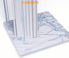 Places with similar names to Al Abqa‘ayn, Egypt ::
Disclaimer :: Information on this page comes without warranty of any kind |
||
|
Where is Al Abqa‘ayn? Elevation and coordinates ::
Latitude (lat): 30°52'34"N Longitude (lon): 30°21'7"E
Elevation (approx.): 2m (map arrows pan, magnifying glasses zoom) |
||
|
Visiting Al Abqa‘ayn? Hotel/Accommodation ::
Book a hotel in Al Abqa‘ayn Travel Guide ::
Buy a travel guide for Egypt rental cars ::
car rental offers GPS waypoint ::
download a GPX waypoint (PoI) of Al Abqa‘ayn for your GPS receiver
|
||