|
search place name
|
||
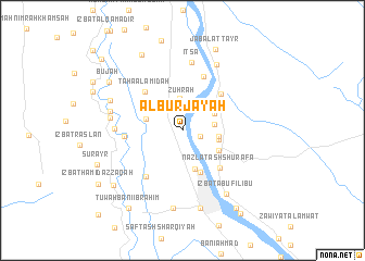
Al Burjāyah (Al Minyā, Egypt)Al Burjāyah is a town in the Al Minyā region of Egypt. An overview map of the region around Al Burjāyah is displayed below.
regional and 3d topo map of Al Burjāyah, Egypt ::
Al Burjāyah airports ::
The nearest airport is CAI - Cairo Intl, located 227.6 km north of Al Burjāyah.
Nearby towns ::
Nazlat Faraj Allāh Mattá (1.7km east) //
Zuhrah (3.1km north) //
Şafţ al Laban (3.3km north) //
Al Ḩawārtah (2.9km east) //
‘Izbat ‘Ibayd Şārūfīm (3.3km north east) //
Ad Dāʼūdīyah (3.3km east) //
Nazlat ad Dāwūdīyah (3.4km east) //
Damshīr (3.5km west) //
Al Minyā (4.2km south) //
Nazlat Ḩusayn ‘Alī (3.9km south east) //
Nazlat al Fallāḩīn (4.1km north west) //
Damārīs (4.6km south) //
Al Ikhşāş (4.6km south) //
Nazālī Ţāḩāʼ (4.5km north west) //
Nazlat ash Shurafāʼ (5.1km south east) //
Ţihnā al Jabal (5.1km north east) //
Ţāḩā al A‘midah (5.3km north west) //
Bihdāl (5.7km south west) //
‘Izbat Bushrá Ḩannā (5.9km north) //
Idmū (5.3km west) //
Banī Ḩasan al Ashrāf (6.1km west) //
Iţsā (7.0km north) //
Hihyā (6.7km west) //
Jabal aţ Ţayr al Qiblī (7.5km north east) //
Mahdīyah (6.9km west) //
‘Izbat Abū Filībū (7.6km south east) //
Ḩasan Bāshā (7.2km north west) //
Tallah (8.1km south) //
Kafr al Manşūrah al Qiblī (8.2km south) //
[all distances 'as the bird flies' and approximate]  Places with similar names to Al Burjāyah, Egypt :: Disclaimer :: Information on this page comes without warranty of any kind |
||
|
Where is Al Burjāyah? Elevation and coordinates ::
Latitude (lat): 28°9'20"N Longitude (lon): 30°44'0"E
Elevation (approx.): 46m (map arrows pan, magnifying glasses zoom) |
||
|
Visiting Al Burjāyah? Hotel/Accommodation ::
Book a hotel in Al Burjāyah Travel Guide ::
Buy a travel guide for Egypt rental cars ::
car rental offers GPS waypoint ::
download a GPX waypoint (PoI) of Al Burjāyah for your GPS receiver
|
||