|
search place name
|
||
Al Ḩimrān (Qinā, Egypt)Al Ḩimrān is a town in the Qinā region of Egypt. An overview map of the region around Al Ḩimrān is displayed below.
regional and 3d topo map of Al Ḩimrān, Egypt ::

Al Ḩimrān airports ::
The nearest airport is LXR - Luxor Intl, located 79.4 km south east of Al Ḩimrān.
Other airports nearby include HRG - Hurghada Intl (200.0 km north east), Nearby towns ::
An Najmah (1.0km south) //
Al Balābīsh Qiblī (1.7km north) //
Naj‘ az Zaydānīyah (1.7km south west) //
Naj‘ al Maḩārzah (1.9km west) //
Al-Qūşah (2.0km east) //
Naj‘ ash Shaykh Mubādir (2.7km north) //
Quşayr Bakhānis (2.7km south west) //
Ash Sharqī Samhūd (3.6km north west) //
Al Balābīsh (4.9km north) //
Ar Rizqah (5.2km south) //
Bakhānis (5.7km south east) //
Al Balābīsh Baḩrī (5.7km north) //
Al Awsaţ Samhūd (5.7km west) //
As Salīmāt (6.7km south west) //
Al Ambīr (6.8km north west) //
Abū Ţisht (6.6km south west) //
Naj‘ al Ţūd (6.3km west) //
Naqnaq (6.9km north west) //
Al Ḩisānāt (7.7km south) //
Naj‘ al ‘Amāyrah (8.0km north) //
Naj‘ Abū Ḑāḩī (8.0km south east) //
Ar Rawātib (7.6km west) //
Naj‘ Turkī (8.4km south) //
Kawm Ya‘qūb (8.2km south west) //
Naj‘ Kawm Majānīn (8.2km south west) //
Al Kushḩ (9.0km north west) //
Kawm al Bijāh (9.5km south east) //
An Naghāmīsh (9.8km north west) //
Ar Rafshah (10.0km south west) //
[all distances 'as the bird flies' and approximate] 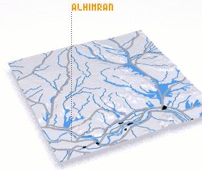
Disclaimer :: Information on this page comes without warranty of any kind |
||
|
Where is Al Ḩimrān? Elevation and coordinates ::
Latitude (lat): 26°10'4"N Longitude (lon): 32°8'5"E
Elevation (approx.): 71m (map arrows pan, magnifying glasses zoom) |
||
|
Visiting Al Ḩimrān? Hotel/Accommodation ::
Book a hotel in Al Ḩimrān Travel Guide ::
Buy a travel guide for Egypt rental cars ::
car rental offers GPS waypoint ::
download a GPX waypoint (PoI) of Al Ḩimrān for your GPS receiver
|
||