|
search place name
|
||
Al Jarnūs (Al Minyā, Egypt)Al Jarnūs is a town in the Al Minyā region of Egypt. An overview map of the region around Al Jarnūs is displayed below.
regional and 3d topo map of Al Jarnūs, Egypt ::

Al Jarnūs airports ::
The nearest airport is CAI - Cairo Intl, located 182.1 km north of Al Jarnūs.
Nearby towns ::
Kafr ash Shaykh Anas (1.4km east) //
Nazlat ‘Aşar (2.1km north west) //
Banī Wāllams (2.4km west) //
Nazlat Aḩmad Yūnus (2.7km north east) //
Shimm al Başal al Qiblīyah (2.9km north east) //
Nazlat Shīḩah (3.1km north) //
Minshāt Niyāzī (3.4km north) //
Shimm al Başal al Baḩrīyah (4.0km north) //
Sāqūlah (3.7km south west) //
Burţubāţ al Jabal (3.9km north west) //
Az Zawarah (4.3km north west) //
Abū Bisht (4.7km north) //
Shulqām (5.0km south) //
Al Bilā‘izitayn (4.9km north west) //
U‘ţū al Waqf (4.9km south east) //
Kawm al Ḩāşil (5.1km north west) //
Kafr aş Şāliḩīn (5.1km north west) //
Sakanāt ‘Arab ‘Alī ‘Abd al Karīm Ruḩayyim (5.0km west) //
Sakanāt ‘Arab ‘Alī ‘Abd as Sayyid (5.0km west) //
Nuqţat Muqaydim al Faʼr (5.5km north east) //
Abā al Waqf (5.1km east) //
Qaryat at Taḩrīr (5.3km west) //
Al ‘Aqlīyah (6.2km north) //
Ishnīn an Naşārá (5.8km east) //
Nazlat Banī Khilf (6.3km north east) //
Banī Khilf (7.1km north east) //
Banī Khālid (7.5km north) //
Abţūjah (7.4km south east) //
Banī ‘Āmir (7.6km north) //
[all distances 'as the bird flies' and approximate] 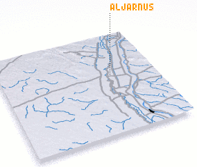 Places with similar names to Al Jarnūs, Egypt :: Disclaimer :: Information on this page comes without warranty of any kind |
||
|
Where is Al Jarnūs? Elevation and coordinates ::
Latitude (lat): 28°35'39"N Longitude (lon): 30°42'58"E
Elevation (approx.): 36m (map arrows pan, magnifying glasses zoom) |
||
|
Visiting Al Jarnūs? Hotel/Accommodation ::
Book a hotel in Al Jarnūs Travel Guide ::
Buy a travel guide for Egypt rental cars ::
car rental offers GPS waypoint ::
download a GPX waypoint (PoI) of Al Jarnūs for your GPS receiver
|
||