|
search place name
|
||
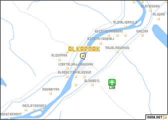
Al Karnak (Qinā, Egypt)Al Karnak is a town in the Qinā region of Egypt. An overview map of the region around Al Karnak is displayed below.
regional and 3d topo map of Al Karnak, Egypt ::
Al Karnak airports ::
The nearest airport is LXR - Luxor Intl, located 7.6 km south east of Al Karnak.
Other airports nearby include ASW - Aswan Intl (194.9 km south), HRG - Hurghada Intl (198.4 km north east), Nearby towns ::
‘Izbat al Ḩājjah Ḑūwah (2.5km south west) //
Al Uqşur (3.7km south) //
Al ‘Asāsīf (3.8km north west) //
Al Ba‘īrāt (3.8km south west) //
Jazīrat al ‘Awwāmīyah (4.1km south west) //
Naj‘ al Khuţbah (4.1km south west) //
Az Zaynīyah Qiblī (5.0km north east) //
Naj‘ ar Rizqah (5.0km south west) //
Al Aqālitah (5.0km south west) //
Al Qurnah (5.0km west) //
Al Ḩubayl (5.8km south) //
Al Bayāḑīyah (5.8km south) //
Naj‘ al Madāmūd (6.9km east) //
Az Zaynīyah Baḩrī (7.5km north east) //
Aş Şa‘āʼidah (8.7km north east) //
Aḑ Ḑab‘īyah (10.0km south west) //
[all distances 'as the bird flies' and approximate] 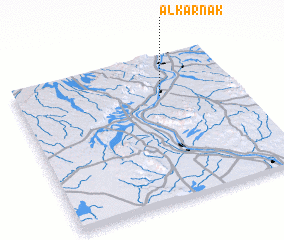 Places with similar names to Al Karnak, Egypt ::
Disclaimer :: Information on this page comes without warranty of any kind |
||
|
Where is Al Karnak? Elevation and coordinates ::
Latitude (lat): 25°43'0"N Longitude (lon): 32°39'0"E
Elevation (approx.): 82m (map arrows pan, magnifying glasses zoom) |
||
|
Visiting Al Karnak? Hotel/Accommodation ::
Book a hotel in Al Karnak Travel Guide ::
Buy a travel guide for Egypt rental cars ::
car rental offers GPS waypoint ::
download a GPX waypoint (PoI) of Al Karnak for your GPS receiver
|
||