|
search place name
|
||
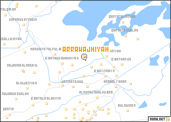
Ar Rawajḩīyah (Ash Sharqīyah, Egypt)Ar Rawajḩīyah is a town in the Ash Sharqīyah region of Egypt. An overview map of the region around Ar Rawajḩīyah is displayed below.
regional and 3d topo map of Ar Rawajḩīyah, Egypt ::
Ar Rawajḩīyah airports ::
The nearest airport is PSD - Port Said, located 47.3 km north east of Ar Rawajḩīyah.
Other airports nearby include CAI - Cairo Intl (103.9 km south west), Nearby towns ::
Tall Tamlīkh (1.7km south east) //
Diyamū (2.7km west) //
‘Izbat Abū Shimays (3.4km south) //
Minshāt Abū ‘Umar (3.0km east) //
‘Izbat an Nāşirīyah (4.1km east) //
‘Izbat aḑ Ḑawahrīyah (4.4km west) //
‘Izbat Zinayn (4.9km south east) //
Al Munājāh (5.7km south) //
‘Izbat Muḩammad as Sa‘dī (5.5km south west) //
Jazīrat Su‘ūd (6.1km south west) //
Kafr al Madīnah (5.5km east) //
Manshīyat al Fūlī al Kabīrah (6.0km west) //
‘Izbat Aḩmad aţ Ţaḩāwī (6.9km south west) //
‘Izbat Mahrān Mu‘āwin (6.6km south east) //
‘Izbat Hanūn (6.9km east) //
Al Munājāh al Kubrá (8.2km south) //
‘Arab al Yaman (8.0km south east) //
Al Ḩusaynīyah (8.5km south west) //
Qaryat aş Şalāḩ (9.3km north east) //
Qaryat al Azhār (11.1km north east) //
[all distances 'as the bird flies' and approximate]  Places with similar names to Ar Rawajḩīyah, Egypt :: Disclaimer :: Information on this page comes without warranty of any kind |
||
|
Where is Ar Rawajḩīyah? Elevation and coordinates ::
Latitude (lat): 30°54'42"N Longitude (lon): 31°59'20"E
Elevation (approx.): 4m (map arrows pan, magnifying glasses zoom) |
||
|
Visiting Ar Rawajḩīyah? Hotel/Accommodation ::
Book a hotel in Ar Rawajḩīyah Travel Guide ::
Buy a travel guide for Egypt rental cars ::
car rental offers GPS waypoint ::
download a GPX waypoint (PoI) of Ar Rawajḩīyah for your GPS receiver
|
||