|
search place name
|
||
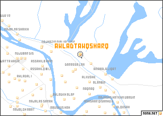
Awlād Ţawq Sharq (Sūhāj, Egypt)Awlād Ţawq Sharq is a town in the Sūhāj region of Egypt. An overview map of the region around Awlād Ţawq Sharq is displayed below.
regional and 3d topo map of Awlād Ţawq Sharq, Egypt ::
Awlād Ţawq Sharq airports ::
The nearest airport is LXR - Luxor Intl, located 93.3 km south east of Awlād Ţawq Sharq.
Other airports nearby include HRG - Hurghada Intl (198.9 km north east), ELT - El-tor El Tor (264.5 km north east), Nearby towns ::
Naj‘al Kallāḩīn (2.3km south east) //
‘Arab al ‘Aţīyāt (2.6km north) //
Dār as Salām (2.9km south west) //
Awlād Ţūq Gharb (3.5km south west) //
Naj‘ Māzin Qiblī al Jisr (5.2km north west) //
Al Kushḩ (5.7km south) //
Naj‘ Birmānah (5.7km south west) //
‘Arab al ‘Alīqāt (6.2km south east) //
Awlād Sālim Baḩrī (6.5km south west) //
An Naghāmīsh (6.9km south) //
Mazātah Sharq (6.4km west) //
Al Ambīr (7.8km south east) //
Naqnaq (8.5km south) //
Naj‘ al ‘Amāyrah (8.0km south east) //
Al Balyanā (8.1km south west) //
Al Balābīsh Baḩrī (8.9km south east) //
Al Balābīsh (10.4km south east) //
As Samaţā (10.7km south west) //
[all distances 'as the bird flies' and approximate]  Places with similar names to Awlād Ţawq Sharq, Egypt :: Disclaimer :: Information on this page comes without warranty of any kind |
||
|
Where is Awlād Ţawq Sharq? Elevation and coordinates ::
Latitude (lat): 26°17'0"N Longitude (lon): 32°4'0"E
Elevation (approx.): 65m (map arrows pan, magnifying glasses zoom) |
||
|
Visiting Awlād Ţawq Sharq? Hotel/Accommodation ::
Book a hotel in Awlād Ţawq Sharq Travel Guide ::
Buy a travel guide for Egypt rental cars ::
car rental offers GPS waypoint ::
download a GPX waypoint (PoI) of Awlād Ţawq Sharq for your GPS receiver
|
||