|
search place name
|
||
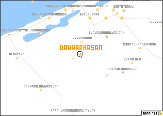
Dawwār Ḩasan (Maţrūḩ, Egypt)Dawwār Ḩasan is a town in the Maţrūḩ region of Egypt. An overview map of the region around Dawwār Ḩasan is displayed below.
regional and 3d topo map of Dawwār Ḩasan, Egypt ::
Dawwār Ḩasan airports ::
The nearest airport is ALY - Alexandria Intl, located 56.7 km north east of Dawwār Ḩasan.
Other airports nearby include CAI - Cairo Intl (197.8 km south east), Nearby towns ::
Dawwār Khamīs (1.6km west) //
Dawwār Ḩamad (3.7km north) //
Qaryat az Zuhūr (6.4km south east) //
Burj al ‘Arab al Jadīdah (7.0km north east) //
[all distances 'as the bird flies' and approximate] 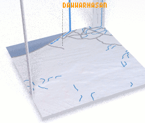 Places with similar names to Dawwār Ḩasan, Egypt ::
// Dreehusen (DE)
// Dreihausen (DE)
// Dreihausen (DE)
// Driehausen (DE)
// Durrhausen (DE)
// Dārhōzān (IQ)
// Durhasan (TR)
// Durhasan (TR)
// Durhasan (TR)
// Durhasan (TR)
Disclaimer :: Information on this page comes without warranty of any kind |
||
|
Where is Dawwār Ḩasan? Elevation and coordinates ::
Latitude (lat): 30°50'0"N Longitude (lon): 29°31'0"E
Elevation (approx.): 56m (map arrows pan, magnifying glasses zoom) |
||
|
Visiting Dawwār Ḩasan? Hotel/Accommodation ::
Book a hotel in Dawwār Ḩasan Travel Guide ::
Buy a travel guide for Egypt rental cars ::
car rental offers GPS waypoint ::
download a GPX waypoint (PoI) of Dawwār Ḩasan for your GPS receiver
|
||