|
search place name
|
||
Dayr al Barshā (Al Minyā, Egypt)Dayr al Barshā is a town in the Al Minyā region of Egypt. An overview map of the region around Dayr al Barshā is displayed below.
regional and 3d topo map of Dayr al Barshā, Egypt ::

Nearby towns ::
Nazlat al Barshā (2.0km south) //
Naj‘ ‘Arab al Burj (2.5km south) //
Al Barshā (3.3km south west) //
Al Barshā (3.3km south west) //
Al Bayāḑīyah (3.3km north west) //
Dayr Abū Ḩinnis (3.6km north) //
Ar Rayramūn (3.9km west) //
Ash Shaykh ‘Ibādah (6.5km north west) //
Ar Rawḑah (6.6km north west) //
Al Ma‘şarah (7.2km south west) //
Mallawī (6.8km west) //
Qulubbā (7.4km west) //
Minshāt Samhān (9.1km south west) //
Naj‘ Shaybah (9.5km north west) //
Qalandūl (9.7km north west) //
Naj‘ Shībah ash Sharqī (10.2km north west) //
Ash Shaykh Ḩusayn (10.6km south west) //
[all distances 'as the bird flies' and approximate] 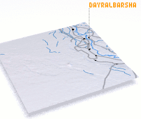 Places with similar names to Dayr al Barshā, Egypt ::
// Douar el Borch (MA)
Disclaimer :: Information on this page comes without warranty of any kind |
||
|
Where is Dayr al Barshā? Elevation and coordinates ::
Latitude (lat): 27°45'19"N Longitude (lon): 30°54'17"E
Elevation (approx.): 51m (map arrows pan, magnifying glasses zoom) |
||
|
Visiting Dayr al Barshā? Hotel/Accommodation ::
Book a hotel in Dayr al Barshā Travel Guide ::
Buy a travel guide for Egypt rental cars ::
car rental offers GPS waypoint ::
download a GPX waypoint (PoI) of Dayr al Barshā for your GPS receiver
|
||