|
search place name
|
||
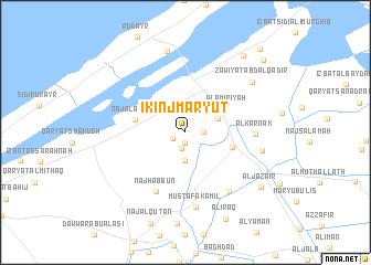
Īkinj Maryūţ (Al Iskandarīyah, Egypt)Īkinj Maryūţ is a town in the Al Iskandarīyah region of Egypt. An overview map of the region around Īkinj Maryūţ is displayed below.
regional and 3d topo map of Īkinj Maryūţ, Egypt ::
Īkinj Maryūţ airports ::
The nearest airport is ALY - Alexandria Intl, located 27.4 km north east of Īkinj Maryūţ.
Other airports nearby include CAI - Cairo Intl (184.5 km south east), Nearby towns ::
Dawwār al Ḩājj Khalīl (1.0km south) //
Al Wādī (1.3km south west) //
Naj‘ Abū Bisīsah (1.7km south) //
Madīnat an Nāşirīyah (1.6km east) //
Dawwār Abū Basīsah (2.9km south) //
An Nāşirīyah (3.2km north east) //
Al ‘Āmirīyah (4.4km north east) //
Aḩmad ‘Urābī (4.3km east) //
Naj‘ al Aḩwāl (4.6km west) //
Naj‘ Ḩabbūn (6.5km south west) //
Al Karnak (6.1km east) //
Filasţīn (7.1km south east) //
Muşţafá Kāmil (7.6km south) //
Abū Sinbil (6.9km east) //
Zāwiyat ‘Abd al Qādir (7.7km north east) //
‘Izbat ‘Umar Abū Ḩafīz̧ah (8.4km north) //
Al Jazāʼir (8.6km south east) //
Al ‘Irāq (9.4km south) //
‘Izbat al Musta‘marah (9.2km north east) //
Madīnat Mubārak (9.9km north east) //
‘Izbat Murghib al Mustajadah (10.6km north east) //
[all distances 'as the bird flies' and approximate] 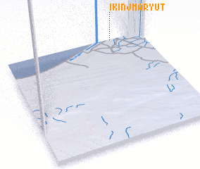 Places with similar names to Īkinj Maryūţ, Egypt :: Disclaimer :: Information on this page comes without warranty of any kind |
||
|
Where is Īkinj Maryūţ? Elevation and coordinates ::
Latitude (lat): 30°59'33"N Longitude (lon): 29°46'0"E
Elevation (approx.): 17m (map arrows pan, magnifying glasses zoom) |
||
|
Visiting Īkinj Maryūţ? Hotel/Accommodation ::
Book a hotel in Īkinj Maryūţ Travel Guide ::
Buy a travel guide for Egypt rental cars ::
car rental offers GPS waypoint ::
download a GPX waypoint (PoI) of Īkinj Maryūţ for your GPS receiver
|
||