|
search place name
|
||
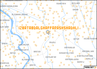
‘Izbat ‘Abd al Ghaffār ash Shādhlī (Kafr ash Shaykh, Egypt)‘Izbat ‘Abd al Ghaffār ash Shādhlī is a town in the Kafr ash Shaykh region of Egypt. An overview map of the region around ‘Izbat ‘Abd al Ghaffār ash Shādhlī is displayed below.
regional and 3d topo map of ‘Izbat ‘Abd al Ghaffār ash Shādhlī, Egypt ::
‘Izbat ‘Abd al Ghaffār ash Shādhlī airports ::
The nearest airport is ALY - Alexandria Intl, located 88.2 km west of ‘Izbat ‘Abd al Ghaffār ash Shādhlī.
Other airports nearby include CAI - Cairo Intl (111.9 km south east), PSD - Port Said (135.8 km east), Nearby towns ::
‘Izbat ‘Abd al Fattāḩ ad Dardīrī (0.7km north east) //
‘Izbat ‘Abd al Majīd ash Shādhlī (0.9km south) //
‘Izbat al Aţrash (1.4km north east) //
Minshāt Shubrāţū (1.3km west) //
‘Izbat ‘Uthmān Shawqī (1.4km east) //
Kunayyisat Shubrā Ţū (1.6km south west) //
‘Izbat Samīr Khalīl (1.7km south east) //
Kafr ‘Ashshūsh (1.8km north west) //
Shubrā Ţū (2.4km south west) //
‘Izbat ‘Alī Misharraf (2.4km north east) //
‘Izbat al Marāzaqah aş Şaghīrah (2.6km north east) //
Kafr al ‘Ilw (2.6km west) //
‘Izbat Jūdah (2.7km north east) //
‘Izbat ‘Ayn al Ḩayāh al Baḩrīyah (3.4km north east) //
Şarawah (3.5km north west) //
Qūnah (3.2km west) //
‘Izbat Abū Turāb (3.6km north east) //
‘Izbat Kafr Abū Ţawr (3.5km north west) //
Kafr Abū Na‘īm (3.4km west) //
Ash Shīn (3.5km east) //
Qallīn (4.2km north) //
Salāmūn al Ghubār (3.7km west) //
Balankūmah (3.8km west) //
Najrīj (4.4km south) //
Mīt Sharīf (4.6km south) //
‘Izbat ‘Ayn al Ḩayāh (4.2km north east) //
‘Izbat Kafr Abū Ḩaţab (4.3km north west) //
Al Kafr al Baḩrī (4.7km north) //
‘Izbat aţ Ţanţāwī (4.3km north west) //
[all distances 'as the bird flies' and approximate] 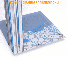 Places with similar names to ‘Izbat ‘Abd al Ghaffār ash Shādhlī, Egypt :: Disclaimer :: Information on this page comes without warranty of any kind |
||
|
Where is ‘Izbat ‘Abd al Ghaffār ash Shādhlī? Elevation and coordinates ::
Latitude (lat): 31°0'36"N Longitude (lon): 30°51'4"E
Elevation (approx.): 4m (map arrows pan, magnifying glasses zoom) |
||
|
Visiting ‘Izbat ‘Abd al Ghaffār ash Shādhlī? Hotel/Accommodation ::
Book a hotel in ‘Izbat ‘Abd al Ghaffār ash Shādhlī Travel Guide ::
Buy a travel guide for Egypt rental cars ::
car rental offers GPS waypoint ::
download a GPX waypoint (PoI) of ‘Izbat ‘Abd al Ghaffār ash Shādhlī for your GPS receiver
|
||