|
search place name
|
||
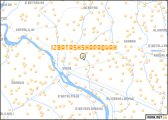
‘Izbat ash Sharāqwah (Kafr ash Shaykh, Egypt)‘Izbat ash Sharāqwah is a town in the Kafr ash Shaykh region of Egypt. An overview map of the region around ‘Izbat ash Sharāqwah is displayed below.
regional and 3d topo map of ‘Izbat ash Sharāqwah, Egypt ::
‘Izbat ash Sharāqwah airports ::
The nearest airport is ALY - Alexandria Intl, located 69.6 km west of ‘Izbat ash Sharāqwah.
Other airports nearby include CAI - Cairo Intl (134.3 km south east), PSD - Port Said (149.4 km east), Nearby towns ::
Dimrū Salmān (1.4km north) //
‘Izbat al Fār al Qiblīyah (1.4km south east) //
‘Izbat Sīdī Jāmi‘ (1.3km west) //
Kunayyisat aş Şarādūsī (1.8km north) //
Kafr al ‘Arab (2.0km south) //
‘Izbat al Kawm al Kabīr (1.8km west) //
‘Izbat Ḩusayn Wahbī Rāghib (1.9km south west) //
‘Izbat al Malā‘ib (2.1km north east) //
‘Izbat ‘Abd al Jawwād (2.3km south east) //
‘Izbat ‘Abd al Karīm Abū Raʼs (2.6km east) //
‘Izbat al Işlāḩ (3.2km north) //
Kawm an Nişf (3.3km north) //
‘Izbat ash Shaykh Ḩajjāj Rifā‘ī (2.9km west) //
‘Izbat Sulaymān Wahbah (3.7km south) //
‘Izbat ‘Alī al Mallāḩ (3.3km north west) //
Kawm al Jazīrah (3.4km north east) //
‘Izbat al Qaffāşah (3.7km south east) //
‘Izbat al Fār (3.8km north west) //
‘Izbat Ḩawḑ al Ḩajar (3.8km south east) //
‘Izbat al Milḩayn (4.0km north west) //
‘Izbat Fāţimah Hānim (3.8km west) //
Disūq (4.4km south west) //
‘Izbat Mursī al Mallāḩ (4.3km north west) //
‘Izbat Kāmil al Wakīl (4.2km west) //
Shabās al Milḩ (4.9km north west) //
Al Uşayfir (4.7km north east) //
‘Izbat al Biţāwī (5.0km south east) //
Kafr Ibrâhîm (5.3km south) //
Abyūqā (4.7km east) //
[all distances 'as the bird flies' and approximate] 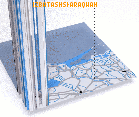 Places with similar names to ‘Izbat ash Sharāqwah, Egypt ::
// ‘Izbat ash Sharāqwah (EG)
// ‘Izbat ash Sharqāwī (EG)
Disclaimer :: Information on this page comes without warranty of any kind |
||
|
Where is ‘Izbat ash Sharāqwah? Elevation and coordinates ::
Latitude (lat): 31°9'27"N Longitude (lon): 30°40'43"E
Elevation (approx.): 2m (map arrows pan, magnifying glasses zoom) |
||
|
Visiting ‘Izbat ash Sharāqwah? Hotel/Accommodation ::
Book a hotel in ‘Izbat ash Sharāqwah Travel Guide ::
Buy a travel guide for Egypt rental cars ::
car rental offers GPS waypoint ::
download a GPX waypoint (PoI) of ‘Izbat ash Sharāqwah for your GPS receiver
|
||