|
search place name
|
||
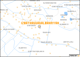
‘Izbat Ḩaddād al Baḩrīyah (Al Buḩayrah, Egypt)‘Izbat Ḩaddād al Baḩrīyah is a town in the Al Buḩayrah region of Egypt. An overview map of the region around ‘Izbat Ḩaddād al Baḩrīyah is displayed below.
regional and 3d topo map of ‘Izbat Ḩaddād al Baḩrīyah, Egypt ::
‘Izbat Ḩaddād al Baḩrīyah airports ::
The nearest airport is ALY - Alexandria Intl, located 45.1 km north west of ‘Izbat Ḩaddād al Baḩrīyah.
Other airports nearby include CAI - Cairo Intl (138.6 km south east), PSD - Port Said (195.3 km east), Nearby towns ::
‘Izbat Nūbār (2.0km west) //
‘Izbat Duktūr Ḩaddād al Wasţānīyah (2.4km south) //
Al Kardūd (3.3km north) //
‘Izbat Būghūş Nūbār ash Sharqīyah (3.3km south west) //
`Ezbet Kôm el-Nigîli (3.7km north west) //
Al Qarīnayn (3.7km north east) //
‘Izbat Qāsim (3.3km west) //
An Nujaylī wa Awlād ash Shaykh (3.9km north west) //
‘Izbat al Ḩuwaylī (4.1km north) //
‘Izbat Būghūş Nūbār al Baḩarīyah (3.9km south west) //
‘Izbat Ḩasan Şāliḩ (4.3km south) //
Naj‘ al Mīrī (4.1km south east) //
‘Izbat ad Duktūr Ḩaddād al Qiblīyah (4.4km south) //
Kafr al Wāq (4.8km north) //
‘Izbat as Suttumāyah (4.8km south) //
‘Izbat al ‘Inānī (4.4km north west) //
‘Izbat Būghūş Nūbār al Qiblīyah (5.1km south west) //
Ţablīyah (5.5km north west) //
Minshaʼat al Balāmūn (5.5km north west) //
‘Izbat Karam Sa‘d Allāh (5.5km north west) //
Al Būţah (5.8km north east) //
‘Izbat Abū Farrāj (6.2km north) //
‘Izbat al Ḩurrīyah (6.4km south) //
Ḩawsh ‘Īsá (6.2km north east) //
‘Izbat Awlād ash Shaykh (6.2km north west) //
Minshāt Jalāwah (6.5km south west) //
Naj‘ Buwayshī (6.9km north west) //
‘Izbat Abū ‘Awf (7.3km north) //
Naj‘ Turūjah (7.0km north west) //
[all distances 'as the bird flies' and approximate] 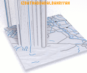 Places with similar names to ‘Izbat Ḩaddād al Baḩrīyah, Egypt :: Disclaimer :: Information on this page comes without warranty of any kind |
||
|
Where is ‘Izbat Ḩaddād al Baḩrīyah? Elevation and coordinates ::
Latitude (lat): 30°52'12"N Longitude (lon): 30°14'57"E
Elevation (approx.): 2m (map arrows pan, magnifying glasses zoom) |
||
|
Visiting ‘Izbat Ḩaddād al Baḩrīyah? Hotel/Accommodation ::
Book a hotel in ‘Izbat Ḩaddād al Baḩrīyah Travel Guide ::
Buy a travel guide for Egypt rental cars ::
car rental offers GPS waypoint ::
download a GPX waypoint (PoI) of ‘Izbat Ḩaddād al Baḩrīyah for your GPS receiver
|
||