|
search place name
|
||
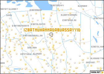
‘Izbat Muḩammad Abū as Sayyid (Kafr ash Shaykh, Egypt)‘Izbat Muḩammad Abū as Sayyid is a town in the Kafr ash Shaykh region of Egypt. An overview map of the region around ‘Izbat Muḩammad Abū as Sayyid is displayed below.
regional and 3d topo map of ‘Izbat Muḩammad Abū as Sayyid, Egypt ::
‘Izbat Muḩammad Abū as Sayyid airports ::
The nearest airport is ALY - Alexandria Intl, located 94.7 km west of ‘Izbat Muḩammad Abū as Sayyid.
Other airports nearby include PSD - Port Said (124.1 km east), CAI - Cairo Intl (136.0 km south), Nearby towns ::
‘Izbat Yūsuf Salāmah (0.6km west) //
‘Izbat Sa‘d Abū ‘Alī (0.7km north) //
‘Izbat Faraj ash Shāmī (0.8km south) //
‘Izbat Biltājī al Fiqī (1.4km west) //
‘Izbat as Sayyid Khalīl (1.6km north west) //
‘Izbat as Sinjābī (2.1km south) //
‘Izbat Bilāl (2.1km south east) //
‘Izbat al Ḩaşafah (2.2km north east) //
‘Izbat Abū Muşţafá (2.4km north) //
‘Izbat aḑ Ḑab‘ah (2.5km south west) //
Qaryat al Muthallath (2.9km south) //
Qaryat ar Raghāmah (3.2km south east) //
‘Izbat ‘Alī Nimr ash Sharqīyah (3.2km south west) //
‘Izbat ‘Alī ‘Abd al Muta‘āl (3.6km south) //
‘Izbat al Makanah (3.8km south) //
‘Izbat Makhālī (3.6km north west) //
‘Izbat ‘Uthmān Bayūmī (3.3km east) //
‘Izbat ar Raşīf (3.9km north) //
‘Izbat al Shawādfī (4.0km north west) //
‘Izbat ad Dawwār (3.7km east) //
Ar Riyāḑ (4.3km south) //
‘Izbat an Nāḩiyatayn (4.6km south) //
‘Izbat Dūmah Maḩmūd Yūnis (4.3km north east) //
Al Waḩḩāl (4.7km south) //
‘Izbat Abū Jayyid (4.8km north) //
‘Izbat Faraj (5.0km south) //
‘Izbat al ‘Iryān (4.9km north east) //
‘Izbat Maţar (5.0km south west) //
‘Izbat Dirbālah (5.3km south) //
[all distances 'as the bird flies' and approximate] 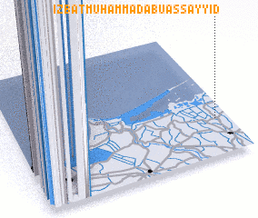 Places with similar names to ‘Izbat Muḩammad Abū as Sayyid, Egypt :: Disclaimer :: Information on this page comes without warranty of any kind |
||
|
Where is ‘Izbat Muḩammad Abū as Sayyid? Elevation and coordinates ::
Latitude (lat): 31°16'48"N Longitude (lon): 30°56'11"E
Elevation (approx.): 3m (map arrows pan, magnifying glasses zoom) |
||
|
Visiting ‘Izbat Muḩammad Abū as Sayyid? Hotel/Accommodation ::
Book a hotel in ‘Izbat Muḩammad Abū as Sayyid Travel Guide ::
Buy a travel guide for Egypt rental cars ::
car rental offers GPS waypoint ::
download a GPX waypoint (PoI) of ‘Izbat Muḩammad Abū as Sayyid for your GPS receiver
|
||