|
search place name
|
||
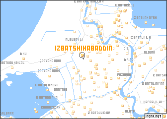
‘Izbat Shihāb ad Dīn (Al Buḩayrah, Egypt)‘Izbat Shihāb ad Dīn is a town in the Al Buḩayrah region of Egypt. An overview map of the region around ‘Izbat Shihāb ad Dīn is displayed below.
regional and 3d topo map of ‘Izbat Shihāb ad Dīn, Egypt ::
‘Izbat Shihāb ad Dīn airports ::
The nearest airport is ALY - Alexandria Intl, located 46.9 km west of ‘Izbat Shihāb ad Dīn.
Other airports nearby include CAI - Cairo Intl (161.5 km south east), PSD - Port Said (173.3 km east), Nearby towns ::
‘Izbat as Sāḩil Raqm 1 (1.0km north east) //
‘Izbat Abū Khamīs (1.4km east) //
‘Izbat as Sāḩil (1.7km north) //
‘Izbat Sīdī ‘Umar (2.1km north east) //
Dabbūn al Malik (2.7km south) //
‘Izbat al Işţabl (2.7km north west) //
Al ‘Izbah al Bayḑāʼ (2.6km south west) //
‘Izbat ar Raml (3.0km north) //
‘Izbat al Muḩīţ (2.7km north west) //
‘Izbat al ‘Ittah (2.8km south east) //
‘Izbat al Kawm (2.8km south east) //
‘Izbat Aḩmad Abū Rukbah (3.2km south east) //
‘Izbat Manshīyat Ismā‘īl ‘Aţīyah (3.3km south east) //
Dabbūn al Khawājah (3.4km south west) //
‘Izbat Sīdī ‘Umar Raqm 3 (3.1km north east) //
‘Izbat Maştā Kawm 3 (3.2km south east) //
Manshīyat al Ghanī (3.8km south) //
Al Ḩammād (3.7km north east) //
Al Buşaylī (3.7km north west) //
Al Fatḩīyah (3.5km north east) //
‘Izbat Maştā al Kubrá (3.9km south east) //
‘Izbat ‘Awaḑ Ḩumaydah (4.3km south) //
‘Izbat Khayr Allāh (4.4km south) //
‘Izbat at Taḩwīlah (4.0km north west) //
‘Izbat Badr (4.6km south) //
‘Izbat Aḩmad Abū ar Riḑá (4.4km south east) //
‘Izbat al Junaydah (4.7km south west) //
Al Ḩammād ash Sharqī (4.7km north east) //
Ash Shamāsimah (4.6km north east) //
[all distances 'as the bird flies' and approximate]  Places with similar names to ‘Izbat Shihāb ad Dīn, Egypt :: Disclaimer :: Information on this page comes without warranty of any kind |
||
|
Where is ‘Izbat Shihāb ad Dīn? Elevation and coordinates ::
Latitude (lat): 31°18'16"N Longitude (lon): 30°25'13"E
Elevation (approx.): 1m (map arrows pan, magnifying glasses zoom) |
||
|
Visiting ‘Izbat Shihāb ad Dīn? Hotel/Accommodation ::
Book a hotel in ‘Izbat Shihāb ad Dīn Travel Guide ::
Buy a travel guide for Egypt rental cars ::
car rental offers GPS waypoint ::
download a GPX waypoint (PoI) of ‘Izbat Shihāb ad Dīn for your GPS receiver
|
||