|
search place name
|
||
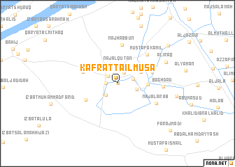
Kafrat Ţāʼil Mūsá (Al Iskandarīyah, Egypt)Kafrat Ţāʼil Mūsá is a town in the Al Iskandarīyah region of Egypt. An overview map of the region around Kafrat Ţāʼil Mūsá is displayed below.
regional and 3d topo map of Kafrat Ţāʼil Mūsá, Egypt ::
Kafrat Ţāʼil Mūsá airports ::
The nearest airport is ALY - Alexandria Intl, located 39.2 km north east of Kafrat Ţāʼil Mūsá.
Other airports nearby include CAI - Cairo Intl (181.4 km south east), Nearby towns ::
Kafrat Sīdī Juwayd (0.0km north) //
Dawwār Ruḩayyim (0.0km north) //
Naj‘ Abū Ḩabbūrah (1.7km north west) //
Dawwār Mişrī (1.6km west) //
Al ‘Awwāmah (1.9km north east) //
Al Qaşr (2.4km south west) //
Ruḩayyim (2.3km east) //
Naj‘ al Quţ‘ān (2.9km north) //
Naj‘ al ‘Arab (2.8km east) //
Abū Bakr (3.8km north east) //
Dawwār Abū Bāsil (3.7km north east) //
Al Başrah (4.1km east) //
Qaryat at Tanmiyah (5.1km south west) //
Dawwār Abū Shā‘ūl (5.1km east) //
Dawwār Abū al ‘Āşī (5.1km west) //
Naj‘ Ḩabbūn (6.2km north) //
Muşţafá Kāmil (6.1km north east) //
Naj‘ al ‘Arab (6.2km south east) //
Baghdād (6.3km east) //
Al ‘Irāq (7.5km north east) //
Filasţīn (9.3km north east) //
Faraj Māḑī (10.4km south east) //
[all distances 'as the bird flies' and approximate]  Places with similar names to Kafrat Ţāʼil Mūsá, Egypt :: Disclaimer :: Information on this page comes without warranty of any kind |
||
|
Where is Kafrat Ţāʼil Mūsá? Elevation and coordinates ::
Latitude (lat): 30°53'0"N Longitude (lon): 29°44'0"E
Elevation (approx.): 26m (map arrows pan, magnifying glasses zoom) |
||
|
Visiting Kafrat Ţāʼil Mūsá? Hotel/Accommodation ::
Book a hotel in Kafrat Ţāʼil Mūsá Travel Guide ::
Buy a travel guide for Egypt rental cars ::
car rental offers GPS waypoint ::
download a GPX waypoint (PoI) of Kafrat Ţāʼil Mūsá for your GPS receiver
|
||