|
search place name
|
||
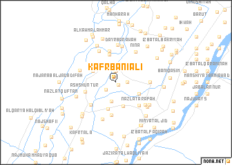
Kafr Banī ‘alī (Banī Suwayf, Egypt)Kafr Banī ‘alī is a town in the Banī Suwayf region of Egypt. An overview map of the region around Kafr Banī ‘alī is displayed below.
regional and 3d topo map of Kafr Banī ‘alī, Egypt ::
Kafr Banī ‘alī airports ::
The nearest airport is CAI - Cairo Intl, located 137.1 km north of Kafr Banī ‘alī.
Nearby towns ::
Minshāt Abū Milīḩ (0.5km south east) //
Banī Muʼminah (1.9km north) //
Şafţ Rāshīn (1.6km east) //
Banī Ḩallah (1.8km south west) //
Fazārah (2.0km north) //
Al Fuqqā‘ī (3.1km south) //
Nazlat Sa‘īd (4.0km south) //
Dashţūţ (3.7km north west) //
Kafr Abū Dukhkhān (3.7km south east) //
Badahl (4.4km south) //
Kawm an Nūr (4.7km north) //
‘Izbat ‘Alī ash Sharīf (5.2km north) //
Ash Shunţūr (4.6km west) //
Nazlat ‘Arafah (4.9km south east) //
Al ‘Asākirah (5.3km south) //
Al Qaşabah (5.1km south west) //
Abū Sharbān (4.9km east) //
Kawm ar Raml al Qiblī (5.6km north west) //
Ninā (5.7km north east) //
Dayr Barāwah (5.9km north) //
Nazlat ‘Alī Kīlānī (5.5km south east) //
Barāwah al Waqf (6.1km north) //
Dishāshah (5.5km west) //
Nazlat ad Dīb (6.3km south) //
Hillīyah (6.0km south east) //
Ţarshūb (6.0km south east) //
Minshāt Ţāhir (6.6km north west) //
Sarabū (6.1km west) //
Rizqat al Mashāriqah (6.9km south east) //
[all distances 'as the bird flies' and approximate]  Places with similar names to Kafr Banī ‘alī, Egypt :: Disclaimer :: Information on this page comes without warranty of any kind |
||
|
Where is Kafr Banī ‘alī? Elevation and coordinates ::
Latitude (lat): 28°58'0"N Longitude (lon): 30°54'0"E
Elevation (approx.): 25m (map arrows pan, magnifying glasses zoom) |
||
|
Visiting Kafr Banī ‘alī? Hotel/Accommodation ::
Book a hotel in Kafr Banī ‘alī Travel Guide ::
Buy a travel guide for Egypt rental cars ::
car rental offers GPS waypoint ::
download a GPX waypoint (PoI) of Kafr Banī ‘alī for your GPS receiver
|
||