|
search place name
|
||
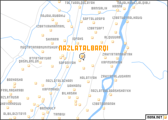
Nazlat al Barqī (Banī Suwayf, Egypt)Nazlat al Barqī is a town in the Banī Suwayf region of Egypt. An overview map of the region around Nazlat al Barqī is displayed below.
regional and 3d topo map of Nazlat al Barqī, Egypt ::
Nazlat al Barqī airports ::
The nearest airport is CAI - Cairo Intl, located 161.9 km north of Nazlat al Barqī.
Nearby towns ::
Al Barqī (0.8km west) //
Nazlat Iqfahş (1.9km north) //
Al Barqī (1.9km north) //
Salāqūs (1.9km south) //
Nazlat an Naşārá (2.2km south east) //
Iqfahş (3.9km north) //
Şafānīyah (3.6km south west) //
Al Kunayyisah (3.8km west) //
Al Fānt (4.2km east) //
Banī Minayn (4.3km west) //
Malāţīyah (5.0km south) //
Bān al ‘Alam (4.6km west) //
Bisfā (5.2km north) //
‘Izbat al Fant (5.3km north east) //
Kafr Minsābah (5.7km north west) //
Kafr Darwīsh (5.6km east) //
‘Izbat Ṣafṭ (6.6km north) //
Dahmarū (6.9km south) //
Banī Wirkān (6.4km west) //
Zāwiyat an Nāwiyah (6.6km east) //
Zāwyet an Nāwyah (6.6km east) //
Al Quḑḑābī (6.9km north east) //
Nazlat al Azharī (7.4km south west) //
Dilhānis (7.8km north) //
Shinará (7.2km north west) //
Mayyānah al Waqf (8.1km south) //
Zāwiyat al Judhāmī (7.7km south east) //
Zāwiyat al Jidāmī (7.7km south east) //
Şafţ al Khirsah (8.5km north) //
[all distances 'as the bird flies' and approximate] 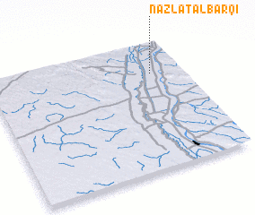 Places with similar names to Nazlat al Barqī, Egypt :: Disclaimer :: Information on this page comes without warranty of any kind |
||
|
Where is Nazlat al Barqī? Elevation and coordinates ::
Latitude (lat): 28°45'0"N Longitude (lon): 30°50'0"E
Elevation (approx.): 31m (map arrows pan, magnifying glasses zoom) |
||
|
Visiting Nazlat al Barqī? Hotel/Accommodation ::
Book a hotel in Nazlat al Barqī Travel Guide ::
Buy a travel guide for Egypt rental cars ::
car rental offers GPS waypoint ::
download a GPX waypoint (PoI) of Nazlat al Barqī for your GPS receiver
|
||