|
search place name
|
||
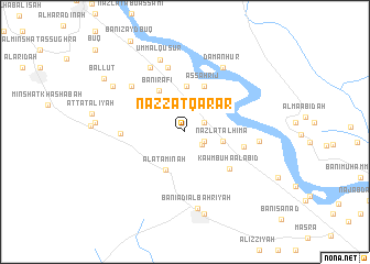
Nazzat Qarār (Asyūţ, Egypt)Nazzat Qarār is a town in the Asyūţ region of Egypt. An overview map of the region around Nazzat Qarār is displayed below.
regional and 3d topo map of Nazzat Qarār, Egypt ::
Nazzat Qarār airports ::
The nearest airport is LXR - Luxor Intl, located 255.9 km south east of Nazzat Qarār.
Nearby towns ::
Banī Majd (2.0km south east) //
Nazlat Rumayḩ (2.0km north east) //
Sarāwah (2.0km south east) //
Nazlat al Ḩimāʼ (3.6km east) //
Al ‘Atāminah (4.3km south west) //
Kawm ash Shahīd (4.6km north) //
Banī Rāfi‘ (4.8km north west) //
Aş Şahrīj (5.0km north) //
Kawm Būhā al ‘Abīd (5.4km south east) //
Manfalūţ (5.6km east) //
Banī Sha‘rān (5.8km west) //
Al Madwār (6.7km north) //
Abū Khalīl (6.7km north west) //
Banī Qurrah (7.2km north west) //
Damanhūr (7.3km north east) //
Jimrīs (6.8km east) //
Umm al Quşūr (7.6km north) //
Banī ‘Adī al Baḩrīyah (7.8km south) //
Banī ‘Adī al Qiblīyah (8.5km south) //
Naj‘ ash Shaykh Ḩarīz (7.9km north west) //
Ballūţ (9.1km north west) //
[all distances 'as the bird flies' and approximate] 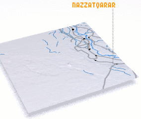 Places with similar names to Nazzat Qarār, Egypt :: Disclaimer :: Information on this page comes without warranty of any kind |
||
|
Where is Nazzat Qarār? Elevation and coordinates ::
Latitude (lat): 27°19'30"N Longitude (lon): 30°54'55"E
Elevation (approx.): 52m (map arrows pan, magnifying glasses zoom) |
||
|
Visiting Nazzat Qarār? Hotel/Accommodation ::
Book a hotel in Nazzat Qarār Travel Guide ::
Buy a travel guide for Egypt rental cars ::
car rental offers GPS waypoint ::
download a GPX waypoint (PoI) of Nazzat Qarār for your GPS receiver
|
||