|
search place name
|
||
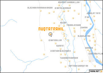
Nuqţat Raḩīl (Al Minyā, Egypt)Nuqţat Raḩīl is a town in the Al Minyā region of Egypt. An overview map of the region around Nuqţat Raḩīl is displayed below.
regional and 3d topo map of Nuqţat Raḩīl, Egypt ::
Nuqţat Raḩīl airports ::
The nearest airport is CAI - Cairo Intl, located 229.9 km north of Nuqţat Raḩīl.
Nearby towns ::
‘Izbat Şāliḩ Bāsil (2.0km north) //
‘Izbat Raslān (2.8km south east) //
Al Kamāl (Nimrah Sab‘ah) (3.6km south west) //
Banī Samraj (4.0km north east) //
Hihyā (4.1km east) //
Mahdīyah (4.2km east) //
Nazlat Shādī (4.7km north east) //
Nazlat Hārūn (5.0km north) //
Ḩasan Bāshā (4.6km north east) //
Banī Ḩasan al Ashrāf (4.6km east) //
Surayr (5.3km south east) //
Būjah (5.6km north east) //
Idmū (5.5km east) //
Al Amal (Nimrah Thamāniyah) (6.9km south) //
‘Izbat Ḩāmid ‘Azzaqāh (7.1km south east) //
‘Izbat al Yamāmah (7.1km north east) //
Manshīyat ash Shiray‘ī (7.7km north) //
Ţūkh al Khayl (7.9km south east) //
Damshīr (7.3km east) //
Nazlat al Fallāḩīn (7.6km east) //
Nazālī Ţāḩāʼ (7.7km east) //
Nazlat ‘Abd aş Şālḩīn ‘Allāj (8.7km north) //
Ţāḩā al A‘midah (7.8km north east) //
Bihdāl (9.3km south east) //
Nazlat al ‘Amūdayn (9.7km north east) //
[all distances 'as the bird flies' and approximate]  Places with similar names to Nuqţat Raḩīl, Egypt :: Disclaimer :: Information on this page comes without warranty of any kind |
||
|
Where is Nuqţat Raḩīl? Elevation and coordinates ::
Latitude (lat): 28°9'50"N Longitude (lon): 30°37'30"E
Elevation (approx.): 34m (map arrows pan, magnifying glasses zoom) |
||
|
Visiting Nuqţat Raḩīl? Hotel/Accommodation ::
Book a hotel in Nuqţat Raḩīl Travel Guide ::
Buy a travel guide for Egypt rental cars ::
car rental offers GPS waypoint ::
download a GPX waypoint (PoI) of Nuqţat Raḩīl for your GPS receiver
|
||