|
search place name
|
||
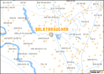
Qalatá aş -ughrá (Al Minūfīyah, Egypt)Qalatá aş -ughrá is a town in the Al Minūfīyah region of Egypt. An overview map of the region around Qalatá aş -ughrá is displayed below.
regional and 3d topo map of Qalatá aş -ughrá, Egypt ::
Qalatá aş -ughrá airports ::
The nearest airport is CAI - Cairo Intl, located 45.2 km south east of Qalatá aş -ughrá.
Other airports nearby include ALY - Alexandria Intl (137.6 km north west), PSD - Port Said (154.4 km north east), Nearby towns ::
Simmân (1.2km south east) //
Kafr al Khaḑrah (1.6km north west) //
Qalatá al Kubrá (1.6km north west) //
Kafr al Kutāmīyah (2.3km east) //
Barāshīm (2.4km south west) //
Al Kutāmīyah (2.4km east) //
Kafr al Ghunāmīyah (2.7km north east) //
Biʼr Shams (2.6km north east) //
Shanshūr (2.8km south west) //
Kawm ‘Ayyād (2.9km south west) //
Tilwānah (3.2km north west) //
Bayy al ‘Arab (4.0km north) //
Al Fir‘awnīyah (3.9km south east) //
Kafr Maḩmūd (4.0km north east) //
Al Qanāţirīn (4.6km south) //
Sinjilf (5.0km north) //
Fīshā (4.9km north west) //
Kafr ad Dawwār (4.5km east) //
Hayt (4.7km north west) //
Kafr Al Fara‘ūnīyah (4.7km south east) //
Kafr Sinjalf al Qadīm (5.5km north) //
Abū Snayţah (5.4km north east) //
Bihnāy (5.2km north east) //
Kafr Sinjilf al Jadīd (5.8km north) //
Kafr al Bājūr (6.2km north) //
Subk al Aḩad (6.2km south) //
Ţanţ al Jazīrah (5.4km east) //
Sirwihayt (5.9km north west) //
Kafr Mujāhid (5.8km west) //
[all distances 'as the bird flies' and approximate] 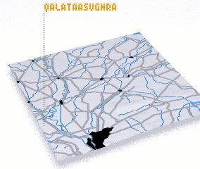 Places with similar names to Qalatá aş -ughrá, Egypt ::
// Kallat Şaghīr (SY)
Disclaimer :: Information on this page comes without warranty of any kind |
||
|
Where is Qalatá aş -ughrá? Elevation and coordinates ::
Latitude (lat): 30°21'44"N Longitude (lon): 31°1'33"E
Elevation (approx.): 17m (map arrows pan, magnifying glasses zoom) |
||
|
Visiting Qalatá aş -ughrá? Hotel/Accommodation ::
Book a hotel in Qalatá aş -ughrá Travel Guide ::
Buy a travel guide for Egypt rental cars ::
car rental offers GPS waypoint ::
download a GPX waypoint (PoI) of Qalatá aş -ughrá for your GPS receiver
|
||