|
search place name
|
||
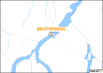
Qal‘at an Nakhl (Shamāl Sīnāʼ, Egypt)Qal‘at an Nakhl is a town in the Shamāl Sīnāʼ region of Egypt. An overview map of the region around Qal‘at an Nakhl is displayed below.
regional and 3d topo map of Qal‘at an Nakhl, Egypt ::
Qal‘at an Nakhl airports ::
The nearest airport is VDA - Ovda, located 115.2 km east of Qal‘at an Nakhl.
Other airports nearby include ETH - Elat Eilat (123.9 km east), AQJ - Aqaba King Hussein Intl (127.7 km east), SKV - St. Catherine St Catherine Intl (139.3 km south), BEV - Beer-sheba Teyman (179.2 km north east), Nearby towns ::
An Nakhl (0.9km north east) //
[all distances 'as the bird flies' and approximate] 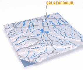 Places with similar names to Qal‘at an Nakhl, Egypt ::
Disclaimer :: Information on this page comes without warranty of any kind |
||
|
Where is Qal‘at an Nakhl? Elevation and coordinates ::
Latitude (lat): 29°54'39"N Longitude (lon): 33°44'36"E
Elevation (approx.): 405m (map arrows pan, magnifying glasses zoom) |
||
|
Visiting Qal‘at an Nakhl? Hotel/Accommodation ::
Book a hotel in Qal‘at an Nakhl Travel Guide ::
Buy a travel guide for Egypt rental cars ::
car rental offers GPS waypoint ::
download a GPX waypoint (PoI) of Qal‘at an Nakhl for your GPS receiver
|
||