|
search place name
|
||
Sindiyūn (Kafr ash Shaykh, Egypt)Sindiyūn is a town in the Kafr ash Shaykh region of Egypt. An overview map of the region around Sindiyūn is displayed below.
regional and 3d topo map of Sindiyūn, Egypt ::

Sindiyūn airports ::
The nearest airport is ALY - Alexandria Intl, located 53.8 km west of Sindiyūn.
Other airports nearby include CAI - Cairo Intl (149.9 km south east), PSD - Port Said (164.8 km east), Nearby towns ::
Dayrūţ (0.8km south west) //
‘Izbat Muḩammad Rajab (1.9km south east) //
‘Izbat S‘ad al Labbān (2.1km west) //
‘Izbat Ḩalq al Jamal (2.6km south) //
‘Izbat al ‘Arab (2.4km north west) //
Taftîsh Ḥalq el-Gamal (2.5km south west) //
Minyat as Sa‘īd (2.6km north west) //
Shamshīrah (3.1km north) //
‘Izbat ash Shāfi‘ī al Labbān (2.8km west) //
Fazārah (3.7km north) //
‘Izbat al Ḩajar (3.3km west) //
‘Izbat Kumbū (4.1km south) //
Manshīyat ‘Ilwān (4.4km north west) //
Al ‘Aţf (4.6km south) //
‘Izbat al Işlāḩ al Qiblīyah (4.2km east) //
‘Izbat al Işlāḩ al Baḩrīyah (4.3km north east) //
Al Maḩmūdīyah (5.1km south) //
Fuwah (4.7km south east) //
‘Izbat al Kushk (5.2km south) //
‘Izbat al Makanah (4.7km north east) //
Niz̧ārat Sīdī ‘Uqbá (4.7km north west) //
‘Izbat al Ḩajar (4.7km east) //
‘Izbat ‘Āshūr (5.2km north east) //
‘Izbat Manshīyat ‘Ilwān Raqm 1 (5.1km north west) //
‘Izbat ash Shayyālīn (5.5km south) //
‘Izbat Aḩmad Wahbān (5.5km south) //
Manshīyat ‘Ilwān Raqm 5 (5.0km north west) //
‘Izbat al Qaşr (5.7km south) //
‘Izbat Ghallāb (5.2km north west) //
[all distances 'as the bird flies' and approximate] 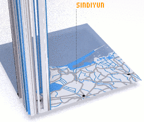 Places with similar names to Sindiyūn, Egypt ::
// Sindiyūn (EG)
// Santayana (ES)
// Sindiyānah (SY)
// Sonityèni (ML)
// Sountyana (ML)
// Saint-Oyen (FR)
// Saint-Yan (FR)
// Saint-Yon (FR)
// Saint-Oyen (IT)
Disclaimer :: Information on this page comes without warranty of any kind |
||
|
Where is Sindiyūn? Elevation and coordinates ::
Latitude (lat): 31°13'51"N Longitude (lon): 30°30'40"E
Elevation (approx.): 8m (map arrows pan, magnifying glasses zoom) |
||
|
Visiting Sindiyūn? Hotel/Accommodation ::
Book a hotel in Sindiyūn Travel Guide ::
Buy a travel guide for Egypt rental cars ::
car rental offers GPS waypoint ::
download a GPX waypoint (PoI) of Sindiyūn for your GPS receiver
|
||