|
search place name
|
||
Tāj ad Duwal wa Kafr ash Shaykh Ismā‘īl (Al Jīzah, Egypt)Tāj ad Duwal wa Kafr ash Shaykh Ismā‘īl is a town in the Al Jīzah region of Egypt. An overview map of the region around Tāj ad Duwal wa Kafr ash Shaykh Ismā‘īl is displayed below.
regional and 3d topo map of Tāj ad Duwal wa Kafr ash Shaykh Ismā‘īl, Egypt ::

nearby GPS traces from timatio ::
Tāj ad Duwal wa Kafr ash Shaykh Ismā‘īl airports ::
The nearest airport is CAI - Cairo Intl, located 19.2 km east of Tāj ad Duwal wa Kafr ash Shaykh Ismā‘īl.
Other airports nearby include PSD - Port Said (166.4 km north east), ALY - Alexandria Intl (173.5 km north west), Nearby towns ::
Imbābah (0.0km north) //
Az Zamālik (0.0km north) //
As Sabtīyah (1.3km east) //
As Sabtīyah (1.3km east) //
Būlāq (1.6km east) //
Mīt ‘Uqbah (2.3km west) //
Shubrā (2.5km north east) //
Bāb al Lūq (2.5km south east) //
Al ‘Ajūzah (2.5km south west) //
Al Ḩūtīyah (2.5km south west) //
Rawḑ al Faraj (2.6km east) //
Al Azbakīyah (2.8km south east) //
Al Azbakīyah (2.8km south east) //
Kafr as Salmānīyah (3.2km north) //
Kafr al Hanādiwah (3.5km north) //
Warrāq al Ḩaḑar (3.8km north) //
Warrāq al Ḩaḑar (3.8km north) //
Bāb ash Sha‘rīyah (3.7km south east) //
Al Qāhirah (3.7km south east) //
Ad Duqqī (4.0km south west) //
Warrāq al ‘Arab (4.2km north) //
Būlāq ad Dakrūr (4.3km south west) //
Bashtīl (4.2km north west) //
‘Ābdīn (4.5km south east) //
‘Ābdīn (4.5km south east) //
As Sayyidah Zaynab (5.1km south east) //
Minyat as Sīrij (4.9km north east) //
Nazlat Bahjat (4.9km south west) //
Al Mu‘tamadīyah (4.7km south west) //
[all distances 'as the bird flies' and approximate] 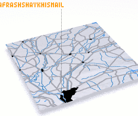 Places with similar names to Tāj ad Duwal wa Kafr ash Shaykh Ismā‘īl, Egypt :: Disclaimer :: Information on this page comes without warranty of any kind |
||
|
Where is Tāj ad Duwal wa Kafr ash Shaykh Ismā‘īl? Elevation and coordinates ::
Latitude (lat): 30°4'0"N Longitude (lon): 31°13'0"E
Elevation (approx.): 33m (map arrows pan, magnifying glasses zoom) |
||
|
Visiting Tāj ad Duwal wa Kafr ash Shaykh Ismā‘īl? Hotel/Accommodation ::
Book a hotel in Tāj ad Duwal wa Kafr ash Shaykh Ismā‘īl Travel Guide ::
Buy a travel guide for Egypt rental cars ::
car rental offers GPS waypoint ::
download a GPX waypoint (PoI) of Tāj ad Duwal wa Kafr ash Shaykh Ismā‘īl for your GPS receiver
|
||