|
search place name
|
||
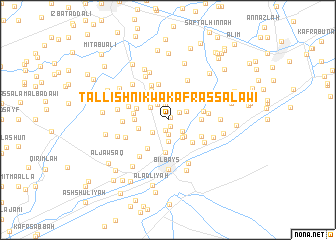
Tall Ishnīk wa Kafr as Salāwī (Ash Sharqīyah, Egypt)Tall Ishnīk wa Kafr as Salāwī is a town in the Ash Sharqīyah region of Egypt. An overview map of the region around Tall Ishnīk wa Kafr as Salāwī is displayed below.
regional and 3d topo map of Tall Ishnīk wa Kafr as Salāwī, Egypt ::
Tall Ishnīk wa Kafr as Salāwī airports ::
The nearest airport is CAI - Cairo Intl, located 41.2 km south of Tall Ishnīk wa Kafr as Salāwī.
Other airports nearby include PSD - Port Said (110.8 km north east), ALY - Alexandria Intl (174.0 km north west), Nearby towns ::
Awlād Sayf (0.4km north east) //
Ar Rawḑah (0.8km south) //
‘Izbat as Sāqiyah al Kabīrah (1.2km south) //
‘Izbat al Malāyqah (1.4km north east) //
‘Izbat al Khashāynah (1.6km south) //
Ad Dahāshinah (1.7km north) //
Al Kafr al Qadīm (1.9km south east) //
Nūbah (2.0km north west) //
Mīt Rabī‘ah al Bayḑah (2.0km south west) //
Awlād Muhannā (2.0km north east) //
‘Izbat ath Thābit (2.3km south) //
‘Izbat ash Shaykh Sa‘d (2.2km north west) //
Kafr Ibrāhīm al ‘Āydī (2.5km south east) //
Al Fārūqīyah (2.4km south east) //
Kafr al ‘Āʼid (2.4km south east) //
Kafr Abāz̧ah (2.9km north) //
‘Izbat al Ḩikr (3.2km north east) //
‘Izbat ‘Arab ar Ramlīyah (3.0km west) //
‘Izbat Hud.hud (3.7km south) //
‘Izbat ash Shurbajī (3.4km north east) //
Kafr Banī ‘Alīm (3.2km east) //
Kafr Abū ‘Abīyah (3.2km west) //
‘Izbat ash Shaykh ‘Īsá (3.3km north west) //
‘Izbat ‘Abd Allāh (3.6km north west) //
Kafr Ayyūb Sulaymān (3.5km south east) //
‘Izbat Ḩawḑ an Nadá (3.3km west) //
‘Izbat Khūrshīd (3.7km south west) //
Minyat Santā (3.5km east) //
Inshāş (4.1km north) //
[all distances 'as the bird flies' and approximate] 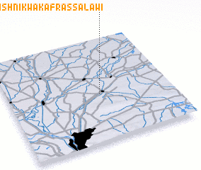 Places with similar names to Tall Ishnīk wa Kafr as Salāwī, Egypt :: Disclaimer :: Information on this page comes without warranty of any kind |
||
|
Where is Tall Ishnīk wa Kafr as Salāwī? Elevation and coordinates ::
Latitude (lat): 30°28'0"N Longitude (lon): 31°34'0"E
Elevation (approx.): 9m (map arrows pan, magnifying glasses zoom) |
||
|
Visiting Tall Ishnīk wa Kafr as Salāwī? Hotel/Accommodation ::
Book a hotel in Tall Ishnīk wa Kafr as Salāwī Travel Guide ::
Buy a travel guide for Egypt rental cars ::
car rental offers GPS waypoint ::
download a GPX waypoint (PoI) of Tall Ishnīk wa Kafr as Salāwī for your GPS receiver
|
||