|
search place name
|
||
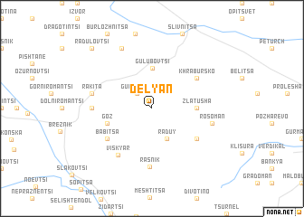
Delyan (Bulgaria)Delyan is a town in Bulgaria. An overview map of the region around Delyan is displayed below.
regional and 3d topo map of Delyan, Bulgaria ::
Delyan airports ::
The nearest airport is SOF - Sofia, located 34.2 km east of Delyan.
Other airports nearby include INI - Nis (112.9 km north west), SKP - Skopje (144.5 km south west), PRN - Pristina (162.4 km west), PDV - Plovdiv (171.0 km south east), Nearby towns ::
Gurgulyat (2.3km north west) //
Raduy (3.9km south) //
Gŭlŭbovtsi (5.0km north) //
Zlatusha (4.1km east) //
Goz (4.5km south west) //
Khrabŭrsko (5.5km north east) //
Babitsa (5.5km south west) //
Mala Rakovitsa (5.5km south east) //
Viskyar (6.5km south west) //
Rasnik (7.2km south) //
Arzan (5.4km west) //
Rakita (5.7km west) //
Rosoman (5.7km east) //
Bratushkovo (7.9km north) //
Radulovtsi (9.2km north west) //
[all distances 'as the bird flies' and approximate]  Places with similar names to Delyan, Bulgaria ::
Disclaimer :: Information on this page comes without warranty of any kind |
||
|
Where is Delyan? Elevation and coordinates ::
Latitude (lat): 42°46'0"N Longitude (lon): 23°0'0"E
Elevation (approx.): 817m (map arrows pan, magnifying glasses zoom) |
||
|
Visiting Delyan? Hotel/Accommodation ::
Book a hotel in Delyan Travel Guide ::
Buy a travel guide for Bulgaria rental cars ::
car rental offers GPS waypoint ::
download a GPX waypoint (PoI) of Delyan for your GPS receiver
|
||