|
search place name
|
||
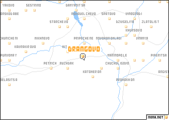
Drangovo (Bulgaria)Drangovo is a town in Bulgaria. An overview map of the region around Drangovo is displayed below.
regional and 3d topo map of Drangovo, Bulgaria ::
Drangovo airports ::
The nearest airport is SKG - Thessaloniki Makedonia, located 103.0 km south of Drangovo.
Other airports nearby include KVA - Kavala Megas Alexandros Intl (125.3 km south east), SOF - Sofia (142.4 km north), PDV - Plovdiv (149.1 km north east), SKP - Skopje (151.0 km north west), Nearby towns ::
Pripechene (3.7km north) //
Mitino (3.3km north west) //
Rupite (3.3km north west) //
Rŭzhdak (3.3km south west) //
Topolnitsa (3.3km south east) //
Katómeron (4.0km south) //
Novo Konomladi (5.6km north east) //
Marino Pole (5.6km east) //
Petrich (5.9km west) //
Chuchuligovo (5.9km east) //
Ribnik (7.9km north) //
Starchevo (8.5km north west) //
[all distances 'as the bird flies' and approximate] 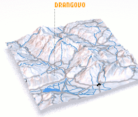 Places with similar names to Drangovo, Bulgaria ::
Disclaimer :: Information on this page comes without warranty of any kind |
||
|
Where is Drangovo? Elevation and coordinates ::
Latitude (lat): 41°25'0"N Longitude (lon): 23°17'0"E
Elevation (approx.): 190m (map arrows pan, magnifying glasses zoom) |
||
|
Visiting Drangovo? Hotel/Accommodation ::
Book a hotel in Drangovo Travel Guide ::
Buy a travel guide for Bulgaria rental cars ::
car rental offers GPS waypoint ::
download a GPX waypoint (PoI) of Drangovo for your GPS receiver
|
||