|
search place name
|
||
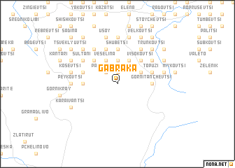
Gabraka (Bulgaria)Gabraka is a town in Bulgaria. An overview map of the region around Gabraka is displayed below.
regional and 3d topo map of Gabraka, Bulgaria ::
Gabraka airports ::
The nearest airport is GOZ - Gorna Orechovica Gorna Oryahovitsa, located 37.5 km north of Gabraka.
Other airports nearby include PDV - Plovdiv (119.2 km south west), BOJ - Bourgas Burgas (138.2 km east), VAR - Varna (165.6 km east), BBU - Bucharest Aurel Vlaicu (186.5 km north), Nearby towns ::
Dragnevtsi (1.9km north) //
Papratliva (2.3km north west) //
Golemi Rŭt (2.3km north west) //
Marinovtsi (3.7km north) //
Nikolchovtsi (3.3km north east) //
Daratsi (3.3km north east) //
Krilyuvtsi (3.9km north) //
Kotutsi (3.9km north) //
Beykovtsi (3.9km north) //
Veselina (3.9km north) //
Ugoryalkovtsi (4.6km north east) //
Buynovtsi (4.6km north east) //
Visokovtsi (4.6km north east) //
Ignatovtsi (4.6km north east) //
Neshevtsi (4.6km north east) //
Ralinovtsi (4.6km north east) //
Kozhlyuvtsi (4.6km north east) //
Pashovtsi (4.6km north east) //
Todyuvtsi (4.6km north west) //
Pelisheni (4.6km north west) //
Shubetsi (5.6km north) //
Lipov Rŭt (4.1km west) //
Gorni Tanchevtsi (4.1km east) //
Dobrevtsi (4.1km west) //
Raynovtsi (5.7km north) //
Topuzi (4.5km north east) //
Kirevtsi (4.5km north west) //
Lazartsi (6.2km north east) //
Dolni Tanchevtsi (6.2km north east) //
[all distances 'as the bird flies' and approximate] 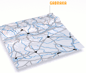 Places with similar names to Gabraka, Bulgaria ::
Disclaimer :: Information on this page comes without warranty of any kind |
||
|
Where is Gabraka? Elevation and coordinates ::
Latitude (lat): 42°50'0"N Longitude (lon): 25°52'0"E
Elevation (approx.): 600m (map arrows pan, magnifying glasses zoom) |
||
|
Visiting Gabraka? Hotel/Accommodation ::
Book a hotel in Gabraka Travel Guide ::
Buy a travel guide for Bulgaria rental cars ::
car rental offers GPS waypoint ::
download a GPX waypoint (PoI) of Gabraka for your GPS receiver
|
||