|
search place name
|
||
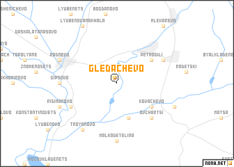
Gledachevo (Bulgaria)Gledachevo is a town in Bulgaria. An overview map of the region around Gledachevo is displayed below.
regional and 3d topo map of Gledachevo, Bulgaria ::
Gledachevo airports ::
The nearest airport is PDV - Plovdiv, located 98.8 km west of Gledachevo.
Other airports nearby include GOZ - Gorna Orechovica Gorna Oryahovitsa (101.4 km north), BOJ - Bourgas Burgas (127.8 km east), AXD - Alexandroupolis Dimokritos (156.8 km south), VAR - Varna (182.8 km north east), Nearby towns ::
Golyama Detelina (5.7km south) //
Pet Mogili (5.5km north east) //
Kovachevo (5.5km south east) //
Ovchartsi (6.9km south east) //
Novoselets (6.6km north east) //
Beli Bryag (6.6km south west) //
Troyanovo (8.5km south west) //
[all distances 'as the bird flies' and approximate] 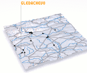 Places with similar names to Gledachevo, Bulgaria ::
// Goldshöfe (DE)
// Gladyshev (RU)
// Gladyshevo (RU)
// Gladyshevo (RU)
// Gladyshevo (RU)
// Kaltashëvo (RU)
// Koldashovo (RU)
// Cloud Chief (US)
// Gladyshevo (RU)
// Koldychëvo (BY)
Disclaimer :: Information on this page comes without warranty of any kind |
||
|
Where is Gledachevo? Elevation and coordinates ::
Latitude (lat): 42°16'0"N Longitude (lon): 26°1'0"E
Elevation (approx.): 141m (map arrows pan, magnifying glasses zoom) |
||
|
Visiting Gledachevo? Hotel/Accommodation ::
Book a hotel in Gledachevo Travel Guide ::
Buy a travel guide for Bulgaria rental cars ::
car rental offers GPS waypoint ::
download a GPX waypoint (PoI) of Gledachevo for your GPS receiver
|
||