|
search place name
|
||
Kokortsi (Bulgaria)Kokortsi is a town in Bulgaria. An overview map of the region around Kokortsi is displayed below.
regional and 3d topo map of Kokortsi, Bulgaria ::

Kokortsi airports ::
The nearest airport is PDV - Plovdiv, located 61.2 km north of Kokortsi.
Other airports nearby include KVA - Kavala Megas Alexandros Intl (69.4 km south), AXD - Alexandroupolis Dimokritos (119.4 km south east), SOF - Sofia (176.3 km north west), LXS - Limnos (180.9 km south), Nearby towns ::
Boevo (0.0km north) //
Dobreva Cheresha (0.0km north) //
Malka Reka (0.0km north) //
Chuchur (2.3km north west) //
Dŭbova (2.3km north east) //
Ostri Pazlak (3.7km north) //
Koynare (2.8km east) //
Rustan (2.8km east) //
Byala Reka (3.7km south) //
Dolen Rudozem (3.3km south east) //
Rudozem (4.0km south) //
Oskrushevo (4.0km south) //
Ravnishte (4.6km north east) //
Podvis (5.6km north) //
Lŭka (5.6km north) //
Voykova Lŭka (5.6km south) //
Polkovnik Serafimovo (4.6km north west) //
Fatovo (4.6km north west) //
Bŭrchevo (5.7km south) //
Rovina (5.7km north) //
Borie (4.6km south east) //
Sopotot (5.7km south) //
Meykovo (5.7km south) //
Leshishte (5.6km north east) //
Elenska (5.6km north east) //
Tŭrŭn (5.6km north east) //
Gorno Fatovo (5.6km north west) //
Kokalich (6.2km south west) //
Razhishte (6.2km north east) //
[all distances 'as the bird flies' and approximate] 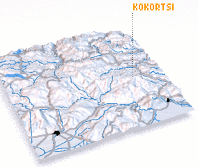 Places with similar names to Kokortsi, Bulgaria ::
// Qağartsi (AZ)
// Köckritz (DE)
// Çakartaş (TR)
// Çakırtaş (TR)
// Çakırtaş (TR)
// Koukouroutazou (GN)
// Kaukaritsa (FI)
// Kokártza (GR)
Disclaimer :: Information on this page comes without warranty of any kind |
||
|
Where is Kokortsi? Elevation and coordinates ::
Latitude (lat): 41°31'0"N Longitude (lon): 24°50'0"E
Elevation (approx.): 835m (map arrows pan, magnifying glasses zoom) |
||
|
Visiting Kokortsi? Hotel/Accommodation ::
Book a hotel in Kokortsi Travel Guide ::
Buy a travel guide for Bulgaria rental cars ::
car rental offers GPS waypoint ::
download a GPX waypoint (PoI) of Kokortsi for your GPS receiver
|
||