|
search place name
|
||
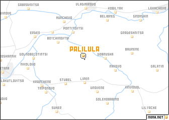
Palilula (Bulgaria)Palilula is a town in Bulgaria. An overview map of the region around Palilula is displayed below.
regional and 3d topo map of Palilula, Bulgaria ::
Palilula airports ::
The nearest airport is SOF - Sofia, located 82.4 km south of Palilula.
Other airports nearby include CRA - Craiova (105.9 km north), INI - Nis (124.8 km west), PDV - Plovdiv (193.6 km south east), SKP - Skopje (218.7 km south west), Nearby towns ::
Okhrid (2.0km north) //
Dobrusha (3.4km east) //
Lipen (5.1km south) //
Portitovtsi (6.5km north) //
Stubel (6.1km south west) //
Boychinovtsi (5.8km north west) //
Rakevo (5.5km south east) //
Urovene (7.3km south) //
Kvartal Ogosta (8.0km north west) //
Mŭrchevo (9.1km north) //
Beli Breg (9.6km north) //
Trifonovo (9.5km south west) //
[all distances 'as the bird flies' and approximate] 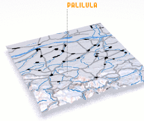 Places with similar names to Palilula, Bulgaria ::
Disclaimer :: Information on this page comes without warranty of any kind |
||
|
Where is Palilula? Elevation and coordinates ::
Latitude (lat): 43°26'13"N Longitude (lon): 23°23'17"E
Elevation (approx.): 119m (map arrows pan, magnifying glasses zoom) |
||
|
Visiting Palilula? Hotel/Accommodation ::
Book a hotel in Palilula Travel Guide ::
Buy a travel guide for Bulgaria rental cars ::
car rental offers GPS waypoint ::
download a GPX waypoint (PoI) of Palilula for your GPS receiver
|
||