|
search place name
|
||
Primortsi (Bulgaria)Primortsi is a town in Bulgaria. An overview map of the region around Primortsi is displayed below.
regional and 3d topo map of Primortsi, Bulgaria ::

Primortsi airports ::
The nearest airport is VAR - Varna, located 35.8 km south of Primortsi.
Other airports nearby include CND - Constanta Mihail Kogalniceanu (101.9 km north east), BOJ - Bourgas Burgas (113.3 km south), BBU - Bucharest Aurel Vlaicu (178.9 km north west), TCE - Tulcea Cataloi (180.2 km north), Nearby towns ::
Polkovnik Minkovo (1.9km north) //
Plachidol (2.3km south west) //
Kotlentsi (2.3km north east) //
Pobeda (3.7km north) //
Polkovnik Sveshtarovo (2.7km east) //
Popgrigorovo (4.6km south east) //
Branishte (4.4km south west) //
Slaveevo (7.5km south) //
Pchelino (7.5km south) //
Yordan Yovkovo (5.7km west) //
Dobrich (5.7km west) //
Stefan Karadzha (7.5km north) //
Stefanovo (7.9km south) //
Bezvoditsa (6.5km south east) //
Verizhari (9.2km north east) //
[all distances 'as the bird flies' and approximate] 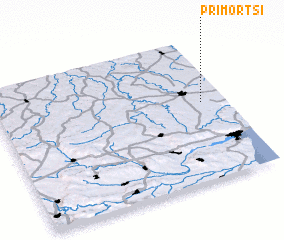
Disclaimer :: Information on this page comes without warranty of any kind |
||
|
Where is Primortsi? Elevation and coordinates ::
Latitude (lat): 43°33'0"N Longitude (lon): 27°54'0"E
Elevation (approx.): 245m (map arrows pan, magnifying glasses zoom) |
||
|
Visiting Primortsi? Hotel/Accommodation ::
Book a hotel in Primortsi Travel Guide ::
Buy a travel guide for Bulgaria rental cars ::
car rental offers GPS waypoint ::
download a GPX waypoint (PoI) of Primortsi for your GPS receiver
|
||